About this artwork
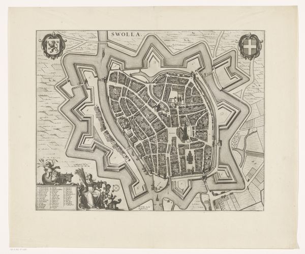
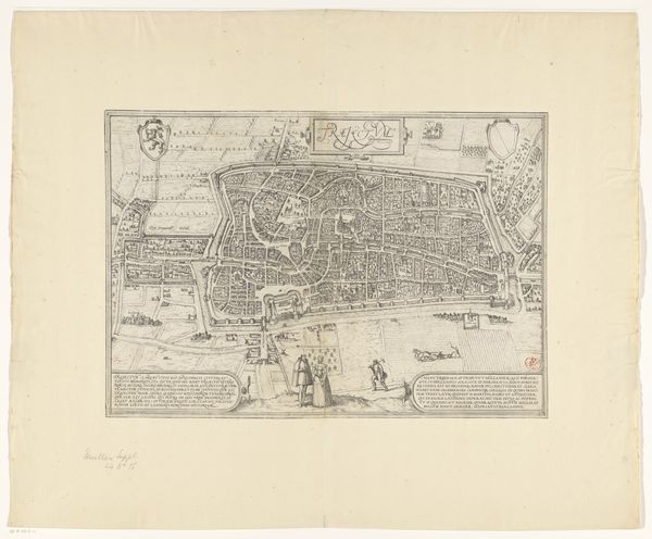
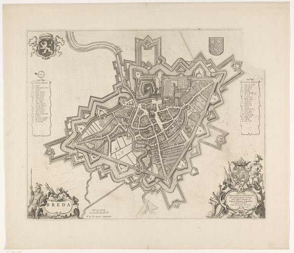
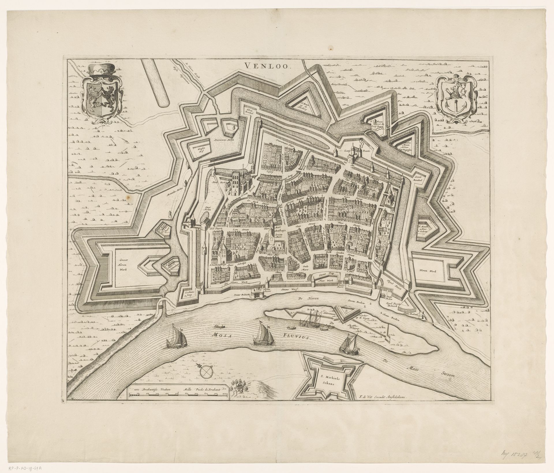
This is an anonymous engraving of Venlo; we don't know when it was made or by whom. The map provides a bird's-eye view of the moated city, reflecting the strategic importance of Venlo as a border city between the Netherlands and Germany. Anonymous maps like this one are intriguing because they often served the interests of those in power – rulers and military leaders. These maps weren’t just about geography; they were instruments of control, illustrating how a city could be defended or conquered. Consider the emotional weight for those who lived in Venlo. This wasn’t just their home; it was a place constantly under threat, a geopolitical pawn whose fate rested on larger political forces. What stories do these fortified walls and strategic waterways tell about the lives of ordinary people? This is more than just a map; it’s a story about power, survival, and the human experience of living in a world shaped by conflict and strategy.
Artwork details
- Medium
- print, engraving
- Dimensions
- height 423 mm, width 524 mm
- Location
- Rijksmuseum
- Copyright
- Rijks Museum: Open Domain
Tags
baroque
dutch-golden-age
cityscape
engraving
Comments
No comments
About this artwork
This is an anonymous engraving of Venlo; we don't know when it was made or by whom. The map provides a bird's-eye view of the moated city, reflecting the strategic importance of Venlo as a border city between the Netherlands and Germany. Anonymous maps like this one are intriguing because they often served the interests of those in power – rulers and military leaders. These maps weren’t just about geography; they were instruments of control, illustrating how a city could be defended or conquered. Consider the emotional weight for those who lived in Venlo. This wasn’t just their home; it was a place constantly under threat, a geopolitical pawn whose fate rested on larger political forces. What stories do these fortified walls and strategic waterways tell about the lives of ordinary people? This is more than just a map; it’s a story about power, survival, and the human experience of living in a world shaped by conflict and strategy.
Comments
No comments