drawing, print, paper, ink, engraving
drawing
baroque
landscape
paper
ink
coloured pencil
cityscape
engraving
Dimensions: height 145 mm, width 218 mm
Copyright: Rijks Museum: Open Domain
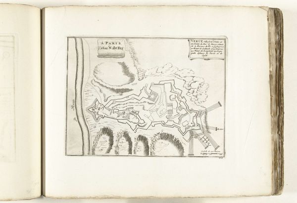
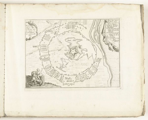
This anonymous map from around 1693-1695, held at the Rijksmuseum, is a detailed rendering of Villefranche-sur-Mer and its surroundings. Executed with delicate lines and precise hatching, the map offers not just geographical data, but a rich interplay of textures and forms. Notice how the engraver uses variations in line density to denote depth and elevation, effectively rendering three-dimensional space on a two-dimensional plane. The strategic placement of fortresses and landmarks also breaks up the composition, acting as semiotic markers that define power and territory. The map becomes a visual language, communicating not only spatial relationships, but also cultural and political claims. The stark contrast between the textured land and the smooth expanse of the sea creates a visual tension. The absence of color focuses our attention on the lines themselves, revealing the structure of the landscape and the hand of the artist. Through this orchestration of form, the map transcends its utilitarian function, prompting us to consider the layers of meaning embedded in its design.
Comments
No comments
Be the first to comment and join the conversation on the ultimate creative platform.