print, engraving
#
aged paper
#
toned paper
#
baroque
#
dutch-golden-age
# print
#
pen sketch
#
old engraving style
#
landscape
#
personal sketchbook
#
pen-ink sketch
#
pen and pencil
#
pen work
#
sketchbook drawing
#
cityscape
#
sketchbook art
#
engraving
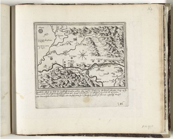
Dimensions: height 248 mm, width 283 mm
Copyright: Rijks Museum: Open Domain
Curator: Look at this, isn't it striking? It’s a 1726 engraving titled "Kaart van de streek tussen Mannheim en Landau," a map of the region between Mannheim and Landau. The artist behind this intricate work is Abraham Allard. Editor: It has this delicate yet formal quality; the fine lines seem so precise and intentional, making me think about journeys, borders, and maybe even conflicts. Curator: You’ve touched on an essential aspect. During this period, cartography was closely intertwined with power. Maps weren't just about geographical accuracy. Editor: Of course! These visual markers define the known world but also control perception and reinforce a certain socio-political power. Just observing all the minute details in the illustration, you perceive that the landscape itself is an emblem, replete with fortified sites that act as both strategic symbols and power markers. Curator: Precisely. The presence of specific cities and territories signals who controlled what and where they stood in relation to one another. It was a language understood by rulers, merchants, and military strategists. Allard’s family had built their whole printing business around cartography and these maps aided Amsterdam's expansion of maritime trade. Editor: The cities are so distinctly rendered. They have their own architectural essence that really emphasizes their place in the land. Curator: Absolutely. And it also represented the cultural and intellectual life centered in cities like Mannheim at the time, part of projecting an image of sophistication and stability in a time of considerable European tension. Editor: When viewing these historical maps, I always get an urge to decode its implied context, that silent historical subtext beneath lines and names. Thank you for pointing out its visual and tangible context, a reminder that even cartography is a visual and influential language. Curator: Yes, the study of imagery, in this instance cartography, is really an excavation of past ideologies!
Comments
No comments
Be the first to comment and join the conversation on the ultimate creative platform.
More like this