drawing, print, etching, ink, engraving
#
drawing
#
baroque
# print
#
etching
#
old engraving style
#
ink line art
#
ink
#
geometric
#
line
#
engraving
Dimensions: height 183 mm, width 265 mm
Copyright: Rijks Museum: Open Domain
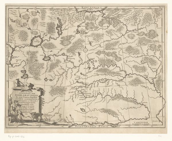
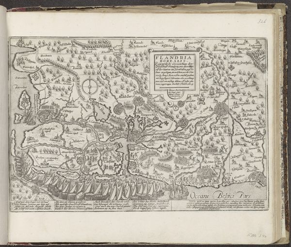
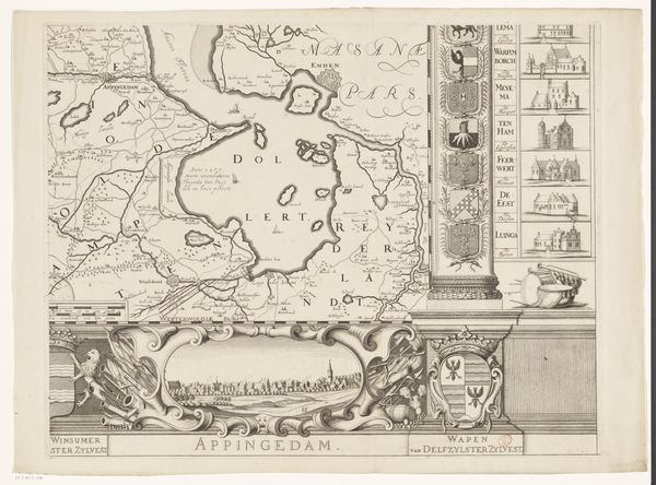
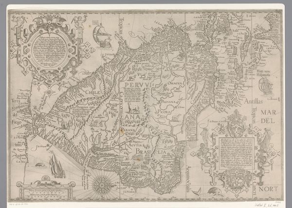
Jan Matthysz.’s Kaart van Westfalen is defined by a delicate network of engraved lines and shapes, carefully mapping geographical features to create a comprehensive representation of the Westfalen region. The black lines delineate rivers, borders, and terrains, contrasting with the blank paper to produce a clear, legible image. This meticulous approach not only serves a practical function but also invites aesthetic contemplation. The map can be viewed as a kind of visual language. It is a semiotic system where each line, symbol, and textual annotation carries specific meaning. Hills are signified by small clustered drawings, cities by dense clusters of tiny buildings, and water bodies by winding parallel lines. Consider the structuralist idea that underlying systems govern cultural phenomena; this map reveals the structuring principles early mapmakers used. It shows the spatial relationships between different settlements, geographical landmarks, and administrative divisions. It goes beyond simple representation to construct a system of signs, where each element contributes to a broader understanding of geographical and cultural space.
Comments
No comments
Be the first to comment and join the conversation on the ultimate creative platform.
More like this