print, paper, engraving
#
baroque
#
ink paper printed
# print
#
landscape
#
paper
#
pen work
#
engraving
Dimensions: height 231 mm, width 332 mm
Copyright: Rijks Museum: Open Domain
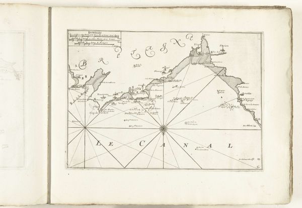
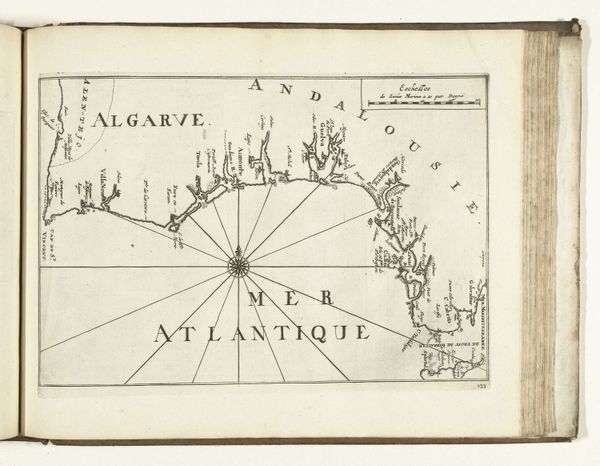
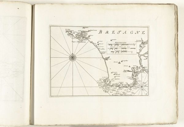
Editor: Here we have "Kaart van de Vlaamse kust, 1726," or "Map of the Flemish Coast, 1726," created by an anonymous artist. It's an engraving printed on paper and currently held at the Rijksmuseum. The first thing that strikes me is its meticulous detail – like an attempt to capture every grain of sand. How do you interpret this work? Curator: The map's power lies in its assertion of control over space. Consider the prominent compass rose: a visual anchor. What feelings does that particular symbol evoke for you? Editor: Navigation, exploration... a sense of charting the unknown. Curator: Precisely. The 'unknown' here isn't necessarily geographical in the traditional sense. Look at the cultural and political context of 1726. Mapping, at this time, represents power. It is a visual claiming of territory. Each tiny building, each marked shoal, underscores a desire to know, and by knowing, to *own*. Note the use of specific symbolic buildings and markers representing power bases along the shoreline. How might the accuracy of this image affected contemporary perception of this territory? Editor: So, the map is not just about geographical accuracy, but about communicating authority? The symbols, buildings, markers... Curator: Absolutely. The map functions almost like propaganda. It embeds a narrative, a claim, deeper than any written text. We need to view this as cultural artifact embedded with intentional visual symbols meant to persuade and stake a claim in collective conscioussness. Editor: I hadn’t considered the propaganda aspect before. This map's precision initially seemed purely informative, but the symbolic depth definitely shifts my perspective. Curator: And it is that constant questioning and re-evaluating our learned assumptions that continues to make these cultural artifacts resonate, all these centuries later.
Comments
No comments
Be the first to comment and join the conversation on the ultimate creative platform.
More like this