drawing, print, paper, ink, engraving
#
drawing
#
baroque
# print
#
paper
#
ink
#
engraving
Dimensions: height 128 mm, width 334 mm
Copyright: Rijks Museum: Open Domain
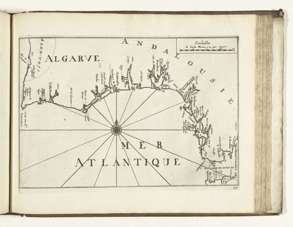
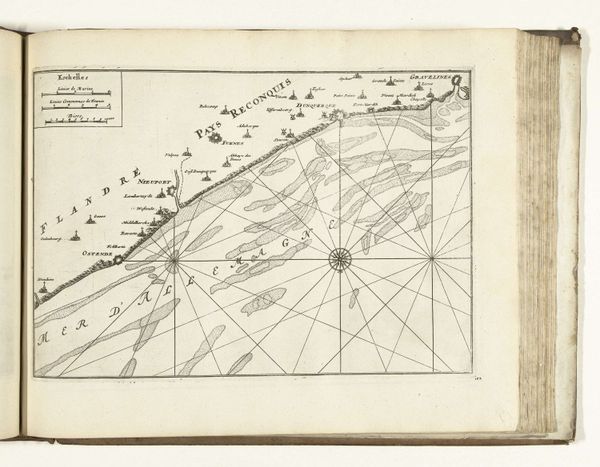
This is an anonymous map of the west coast of Portugal made around 1702. At first glance, the stark contrast of the black lines against the creamy paper creates a striking visual impression, drawing you into its intricate details. The composition is dominated by a network of lines radiating from a central point, structuring the geographical space. The lines are not just representational but form a grid, a semiotic structure that speaks to the scientific and navigational precision of the era. It presents a world neatly ordered and rationalized. This ordering principle, however, can also be seen as a form of control. The map invites us to consider how such visual tools shaped our understanding and interaction with the world. It’s a reminder that every map is not just a depiction but also an interpretation, laden with the power to define and control space.
Comments
No comments
Be the first to comment and join the conversation on the ultimate creative platform.
More like this