print, engraving
#
dutch-golden-age
# print
#
old engraving style
#
geometric
#
line
#
engraving
Dimensions: height 160 mm, width 210 mm
Copyright: Rijks Museum: Open Domain
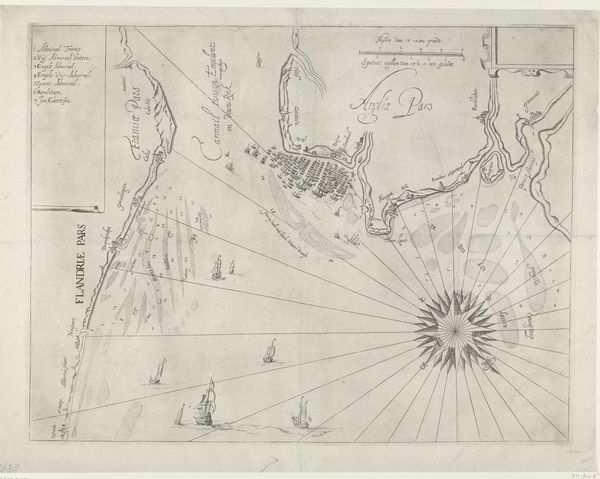
This map of the Le Maire Strait was made in 1624, by an anonymous artist, and depicts the southern tip of Tierra del Fuego. The creation of this map reflects the 17th-century Dutch Republic's burgeoning colonial ambitions, driven by its desire for global trade routes. Cartography during this era was deeply entwined with power, race, and class. It was a tool for claiming territory and controlling resources while often erasing or misrepresenting Indigenous populations. The map highlights the Dutch perspective of the time, reinforcing a sense of European dominance and shaping narratives about the 'New World'. What stories are left out of this map? How does it feel to view a landscape through the eyes of colonizers? Consider the emotional and political implications embedded in this seemingly objective representation of land and sea. This map embodies the complex interplay of exploration, exploitation, and cultural encounter, shaping our understanding of history and identity.
Comments
No comments
Be the first to comment and join the conversation on the ultimate creative platform.
More like this