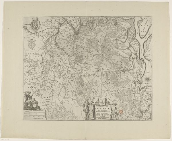
c. 1635 - 1696
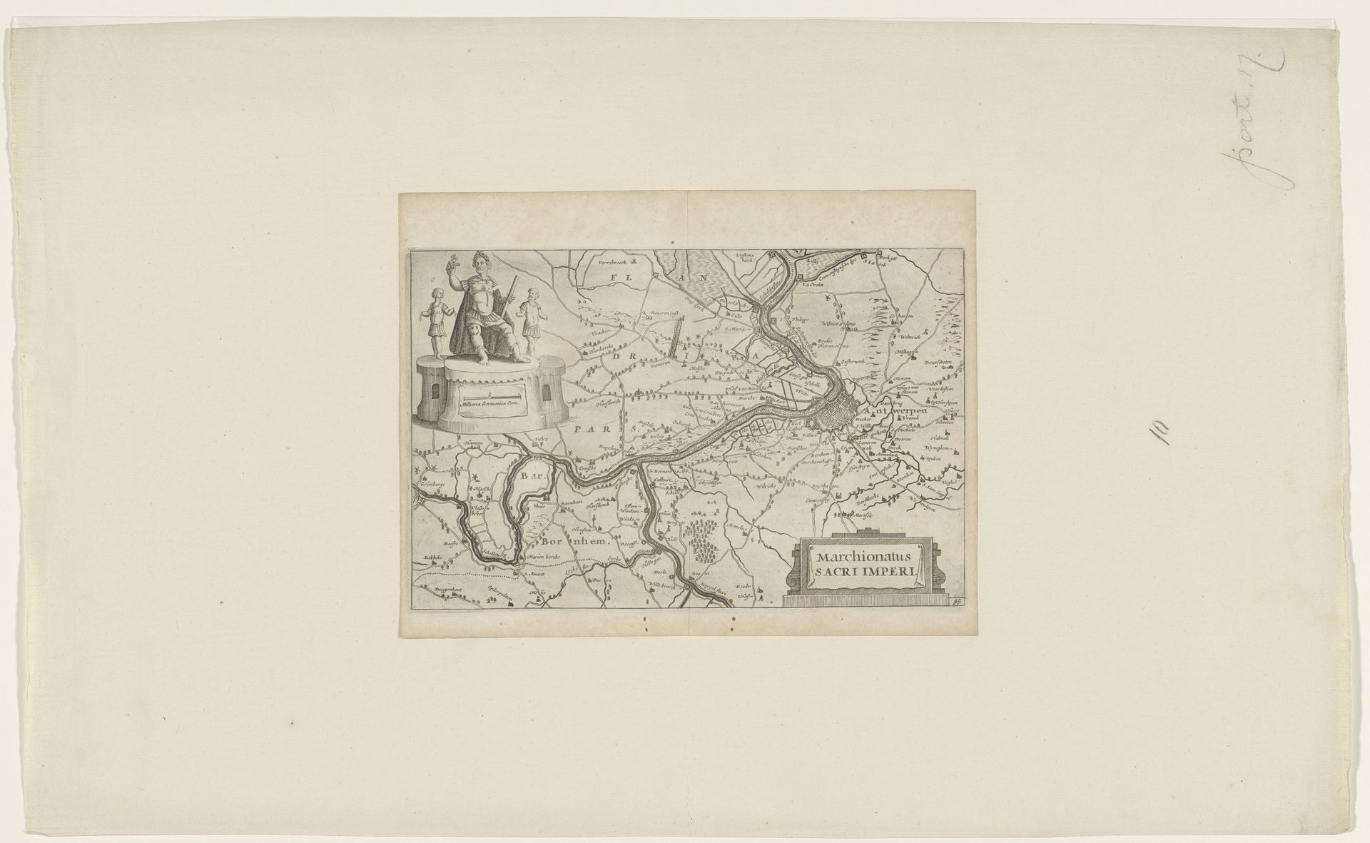
Kaart van Antwerpen en zijn omgeving
Anonymous
@anonymousLocation
RijksmuseumListen to curator's interpretation
Curatorial notes
This is an anonymous map of Antwerp and its surroundings, rendered with meticulous detail. Note the figure atop a pedestal in the upper left. She is an allegorical representation of Antwerp, bearing symbols of power and prosperity. Such figures—personifications of cities and nations—echo the ancient Roman practice of embodying abstract concepts in human form. This motif resurfaces throughout history; think of Britannia, or the Statue of Liberty, each carrying its own set of culturally specific meanings. The river, snaking through the landscape, is not merely a geographical feature; it’s a lifeline, a symbol of commerce and connection. Across time, rivers have symbolized the flow of life itself. The map’s detailed rendering invites contemplation, engaging us on a primal level. These symbols, deeply ingrained in our collective memory, resonate, shaping our understanding of place and identity. Like the twisting river, the map's symbols wind through the centuries, carrying echoes of the past.