drawing, print, paper, ink, engraving
drawing
medieval
pen drawing
landscape
paper
ink
geometric
cityscape
engraving
Dimensions: height 383 mm, width 498 mm
Copyright: Rijks Museum: Open Domain
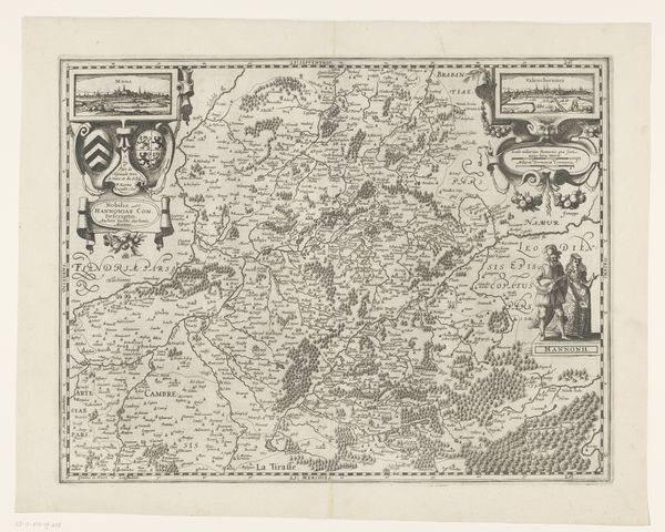
This detailed map of the County of Namur, with a view of the city, was produced by an anonymous artist. Maps such as this one served multiple purposes in their time. On one hand, they were tools for administration, helping rulers understand and control their territories. But they also played a role in shaping identity, both for those who lived in the region and for outsiders. The visual codes used here are telling: the clear delineation of borders, the emphasis on key cities, and the inclusion of heraldic symbols all contribute to a sense of Namur as a distinct and important political entity. Produced in a time of frequent conflict, the map would have been a valuable resource for military strategists. Yet, we shouldn’t overlook its cultural significance. It reflects a growing sense of regional identity, a phenomenon historians trace through archives, landscape paintings, and even literature. By studying these sources together, we can better appreciate the complex relationship between power, knowledge, and representation in early modern Europe.
Comments
No comments
Be the first to comment and join the conversation on the ultimate creative platform.