drawing, ink, pen
#
drawing
#
baroque
#
pen sketch
#
landscape
#
ink
#
geometric
#
15_18th-century
#
pen
#
cityscape
#
history-painting
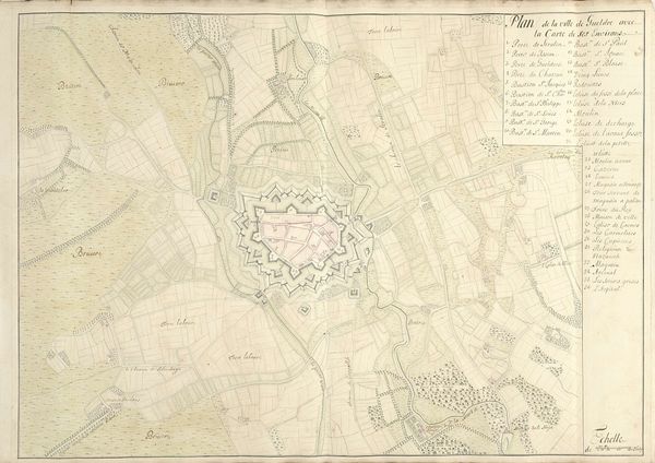
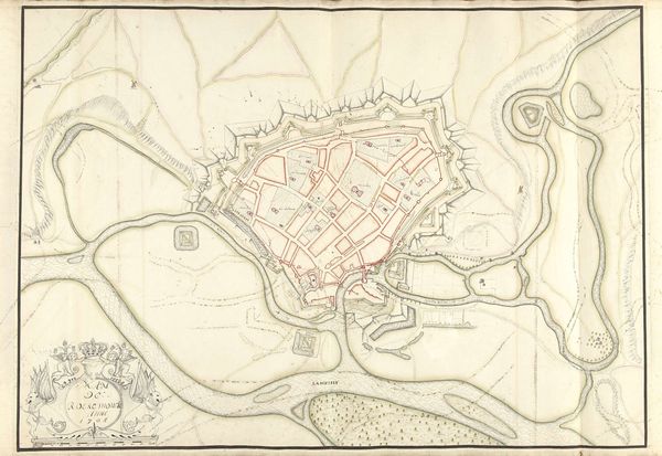
Dimensions: height 394 mm, width 505 mm
Copyright: Rijks Museum: Open Domain
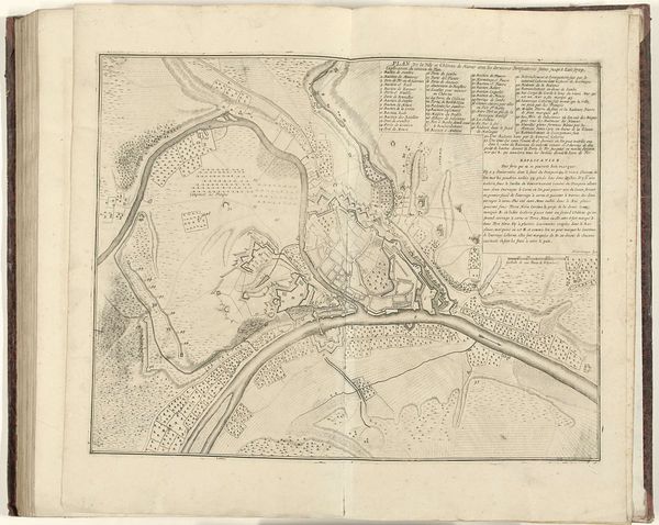
This ‘Plattegrond van Menen’ was carefully rendered on paper in 1708 by Samuel Du Ry de Champdoré, using ink and watercolour. Though seemingly conventional materials, the map's significance lies in its meticulous creation, a process deeply intertwined with the socio-political context of its time. The act of surveying, drafting, and illustrating such a detailed plan demanded not only artistic skill but also a profound understanding of engineering and military strategy. Each line, meticulously drawn, represents not just a physical structure but also a calculated decision about defense and control. Du Ry de Champdoré’s detailed approach imbues the map with a sense of authority and precision, essential for its intended use. The visual quality of the map invites us to consider the labour involved in its production, the expertise required to create it, and its role as a tool for governance and power. This piece challenges our notions of both craft and fine art, emphasizing the skill and purpose behind its creation.
Comments
No comments
Be the first to comment and join the conversation on the ultimate creative platform.
More like this