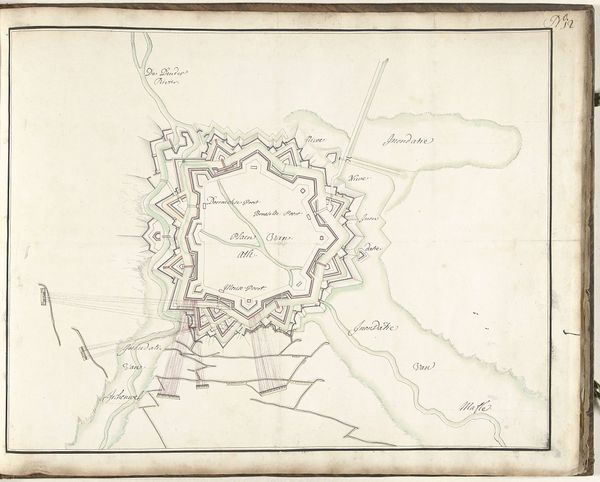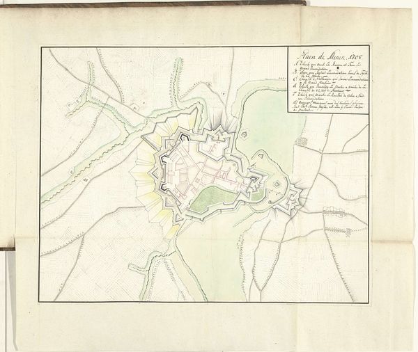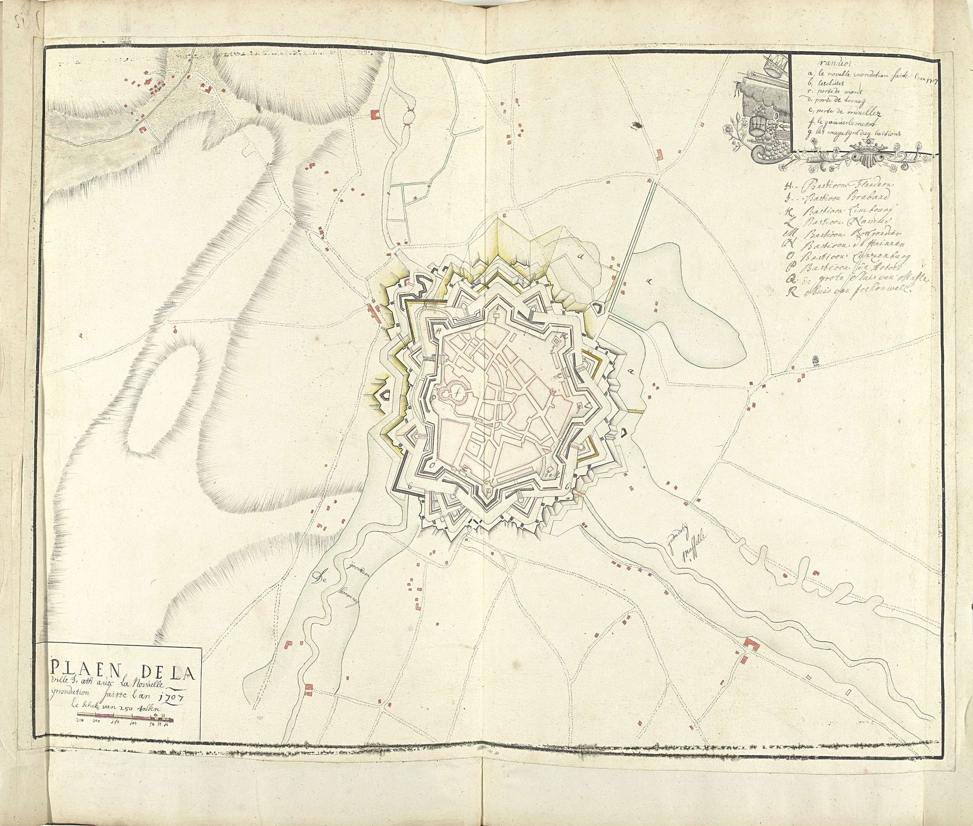
1707
Plattegrond van Ath met inundaties, 1707
Listen to curator's interpretation
Curatorial notes
Samuel Du Ry de Champdoré created this ink and watercolor map of Ath in 1707 to document planned inundations. Cartography in the early 18th century wasn't just about geography; it was deeply intertwined with military strategy and state power. The map meticulously details the town's fortifications, key buildings, and surrounding topography, reflecting the era’s emphasis on military engineering and defensive planning. France, where Du Ry de Champdoré lived, was constantly at war. Institutions like military academies played a crucial role in shaping artistic production of this kind, training artists to serve the state. The map’s creation also reflects the social conditions of the time. Commissioned by military authorities, it illustrates the relationship between artistic skill and the needs of the state. It's progressive in the sense that it uses art for the purposes of science, but conservative insofar as it makes military conquest its purpose. By studying military archives, social histories of the period, and the artist’s biography, we can better understand the complex layers of meaning embedded in this ostensibly straightforward map.