drawing, print, etching, engraving
#
drawing
# print
#
etching
#
etching
#
cityscape
#
engraving
Dimensions: height 320 mm, width 408 mm
Copyright: Rijks Museum: Open Domain
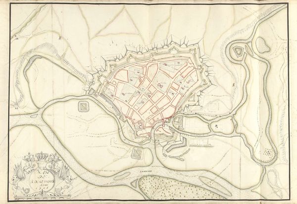
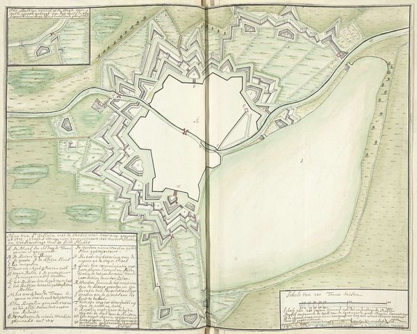
Here we see Samuel Du Ry de Champdoré's "Plattegrond van Zoutleeuw", made in 1705. This map captivates with its intricate geometric forms and muted palette, dominated by earthy tones. The town's layout is meticulously rendered, resembling a complex puzzle of interlocking shapes. Look closely, and you'll notice how the structured design transforms a practical map into an abstract composition. The lines create a rhythm of fortifications and pathways, and the shapes of the buildings and waterways, while representational, possess an aesthetic quality. This fusion of utility and form transcends its cartographic purpose. By emphasizing the structural elements of urban planning, de Champdoré invites us to ponder the underlying order and control imposed on the landscape. The map becomes a semiotic text, its visual components acting as signs that reveal the complex relationship between power, space, and representation. Its precise lines and geometric shapes suggest a rationalized world, yet also hint at the artificiality of such constructed orders.
Comments
No comments
Be the first to comment and join the conversation on the ultimate creative platform.
More like this