print, engraving
#
baroque
#
dutch-golden-age
# print
#
landscape
#
geometric
#
line
#
cityscape
#
engraving
Dimensions: height 140 mm, width 154 mm
Copyright: Rijks Museum: Open Domain
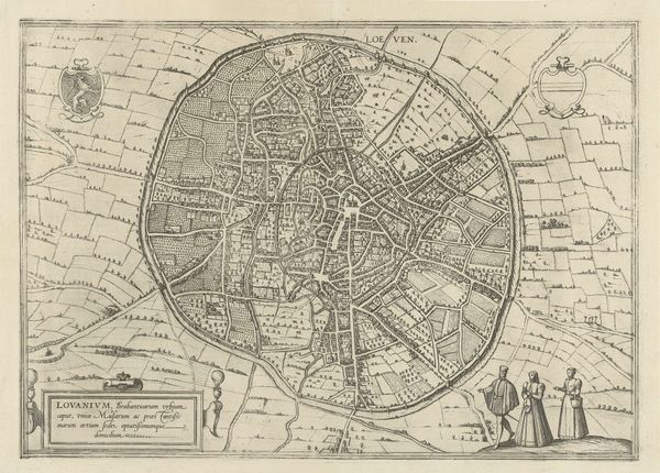
This is an undated anonymous drawing of 'Plattegrond van Lier' whose tight composition and use of line, create a detailed, small-scale rendering of the city. The drawing presents a bird's-eye view, encased within an almost egg-like shape, contained by a continuous line representing the city walls and waterways. The dense, labyrinthine layout of streets and buildings creates a complex visual texture. This intricate design might reflect the city's social structures and power relations. Notice how the buildings are densely packed, suggesting a planned layout that perhaps imposes order onto the landscape and the lives of the people within it. The composition of the drawing challenges fixed meanings, presenting a structured yet organic form. This work isn't just a map; it's a carefully constructed representation of space and power. It embodies a discourse on urban planning and control that continues to resonate today.
Comments
No comments
Be the first to comment and join the conversation on the ultimate creative platform.
More like this