print, engraving
# print
#
pen sketch
#
old engraving style
#
geometric
#
cityscape
#
engraving
Dimensions: height 129 mm, width 156 mm
Copyright: Rijks Museum: Open Domain
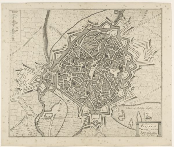
This is an anonymous print of Valenciennes. As a historian, when I see a map like this, I immediately think about power. Who commissioned it, and what did they want it to communicate? The image depicts Valenciennes, a town in Northern France, surrounded by fortifications. The tight urban plan, made legible by the engraver, displays the town’s internal organization but, more importantly, emphasizes its defenses. Maps like this are not neutral records; they reflect the interests of those in charge. In the early modern period, control over territory was a constant negotiation, sometimes resolved through warfare. What does the inclusion of heraldic symbols tell us about the intended audience, or the patron's allegiances? What can local archives tell us about the social and political life of Valenciennes at the time? These are the kinds of questions that help us understand the map's meaning and purpose.
Comments
No comments
Be the first to comment and join the conversation on the ultimate creative platform.
More like this