drawing, print, ink, engraving
drawing
medieval
baroque
pen sketch
ink
geometric
pen-ink sketch
line
pen work
cityscape
engraving
Dimensions: height 200 mm, width 277 mm
Copyright: Rijks Museum: Open Domain
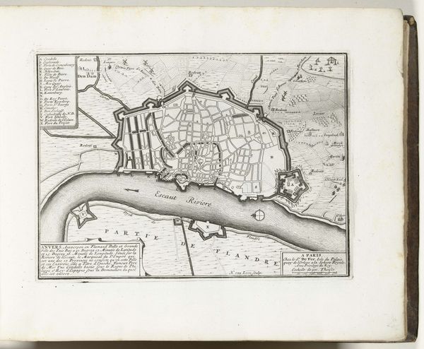
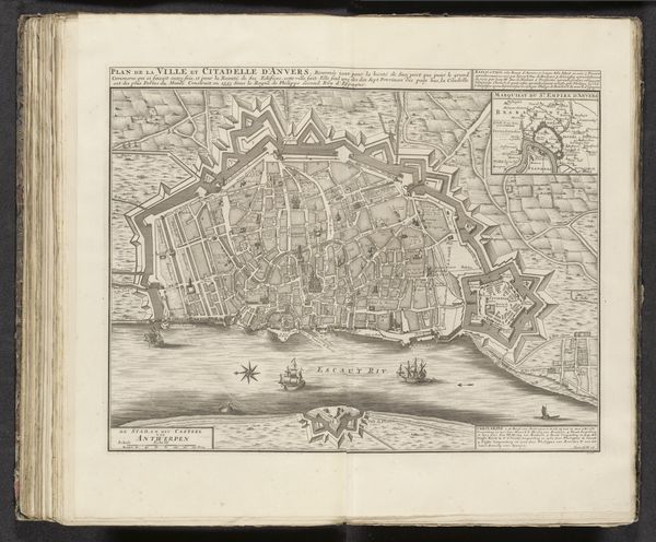
This is a map of Antwerp, made around 1702 by an anonymous artist. It’s made using the intaglio printmaking process; the image incised into a metal plate, likely copper, and then printed onto paper. The fine lines and intricate details that define the city’s layout speak to the engraver’s skill. Consider the labor involved in the production of this map. From the mining and processing of the metal, to the skilled hand work of engraving, and the operation of the printing press – each step required specific expertise, time, and resources. This map would have been a valuable commodity, reflecting Antwerp's status as a major port city. While maps like this are often appreciated for their historical or geographical significance, they are also powerful reminders of the material processes and social contexts that shaped their creation. They challenge us to think about the complex relationships between art, labor, and society.
Comments
No comments
Be the first to comment and join the conversation on the ultimate creative platform.