print, paper, ink, engraving
#
dutch-golden-age
#
ink paper printed
# print
#
paper
#
ink
#
coloured pencil
#
geometric
#
cityscape
#
engraving
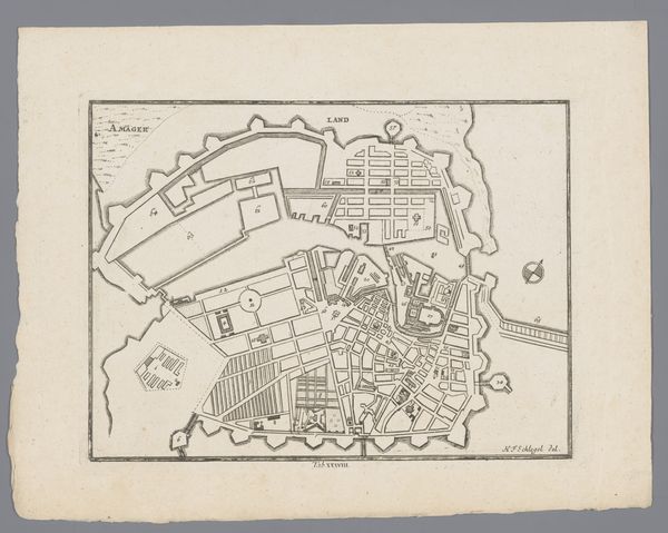
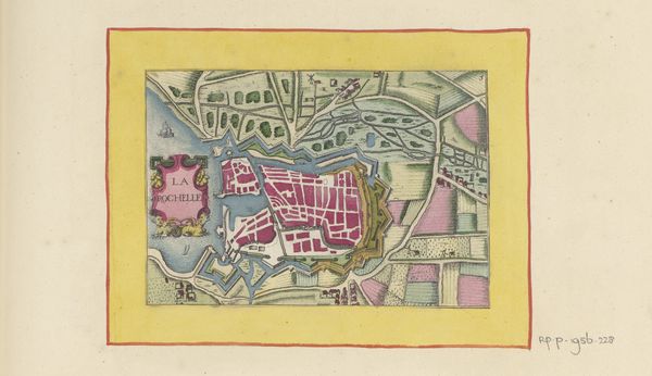
Dimensions: height 93 mm, width 137 mm
Copyright: Rijks Museum: Open Domain
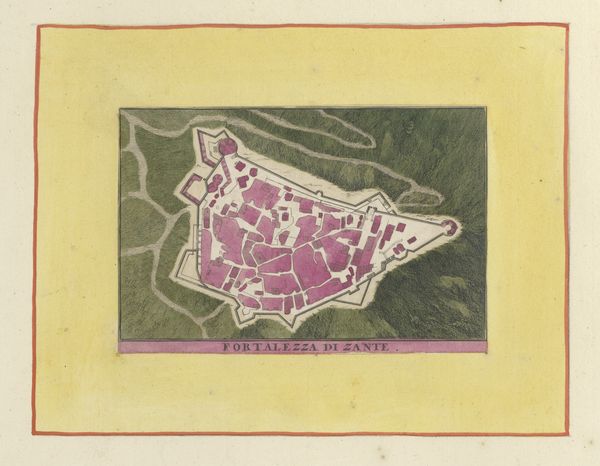
Curator: It looks a bit like a stained-glass window exploded onto a parchment. My eye immediately jumps to those vibrant pink blocks—is that the city itself? Editor: Indeed. Here we have "Kaart van Kythira," a map of Kythira, or Cerigo, as indicated at the bottom of the work. The artist, Willem Swidde, possibly created it between 1679 and 1717. It's a print, using ink on paper—an engraving. Curator: So, a visual representation aiming to distill geography, history, power dynamics, into this two-dimensional form. The strategic, planned layout jumps out; the geometric forms constrained within fortifications speak of a militarized approach to space. How does that interplay with the location’s history and culture? Editor: Well, I find it strangely soothing despite the fortified look you pointed out. Those little squares… they make me think of dollhouses all neatly arranged, though probably life within those walls was anything but doll-like, and probably filled with conflict, especially at a location which represented so many historical and economic trading routes in that particular slice of time. It really offers this simultaneous tension and tranquility. Curator: Absolutely, because when we analyze the geopolitical position of Kythira, strategically located for maritime trade routes and military control, the map functions as more than just a guide; it embodies colonial ambitions, trade dominance, and defensive strategies. How are the populations represented, or rather, omitted? Editor: It’s striking, isn’t it? You see this intricate depiction of space—walls, paths, little suggestion of elevation—but it's all so sterile. I think it is missing that organic energy of humans living and breathing. Although I notice those fine ink drawings which might offer little traces of human activity at the very borders of the island; still, these people are at best ghostly appearances! Curator: Right, and what does that erasure mean in the context of cartography during the Dutch Golden Age? Who was this map intended for? What narratives does it perpetuate or challenge regarding power, ownership, and the "other"? I keep asking myself: what kind of violence, power, race, and control does this visual order seek to legitimize, conceal, or normalize? Editor: Gosh, it’s fascinating to consider. So many possible answers locked inside this little geometric fortress! From my perspective as an artist I find the color choices surprising and somewhat arbitrary, though quite lovely, don’t you think? It somehow breathes an eccentric elegance onto those heavy fortifications! It takes quite an inventive touch to create something so both serious and playful. Curator: Indeed. "Kaart van Kythira" encourages us to think about the multiple layers of meaning embedded in seemingly objective representations. Editor: Definitely gives a lot to reflect on beyond just geographical information.
Comments
No comments
Be the first to comment and join the conversation on the ultimate creative platform.
More like this