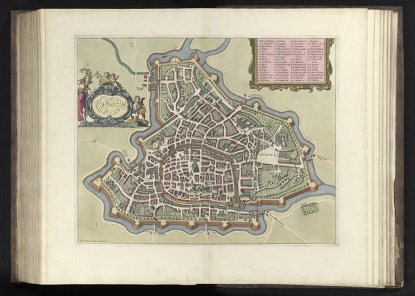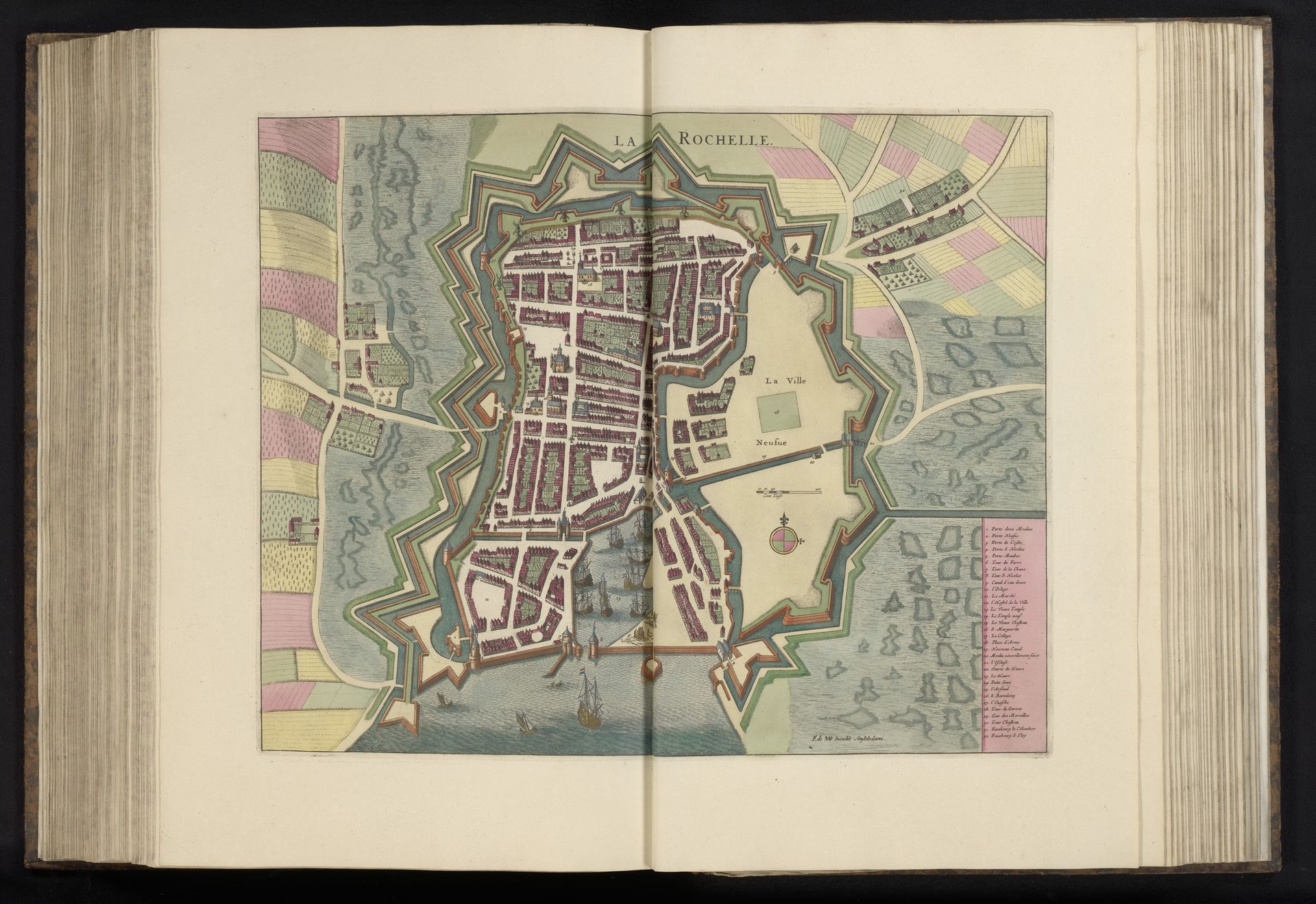
after 1693
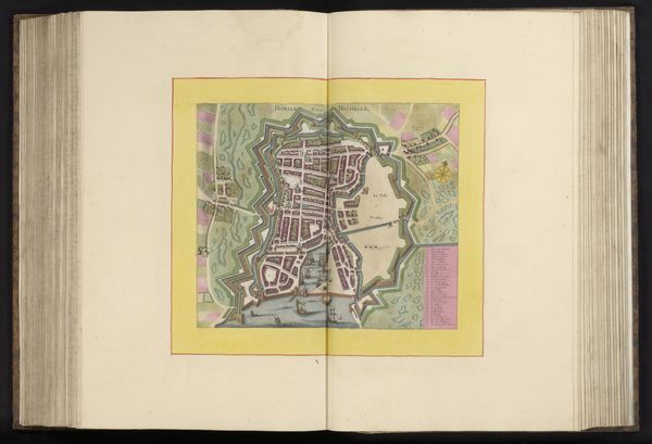
Plattegrond van La Rochelle
Anonymous
@anonymousLocation
RijksmuseumListen to curator's interpretation
Curatorial notes
This is an anonymous, undated map of La Rochelle, presented in a book format. The composition is dominated by the geometric layout of the city, enclosed within a star-shaped fortification. The buildings are depicted as compact blocks, arranged along straight lines. A visual tension is created by the contrast between the orderly urban plan and the irregular, organic shapes of the surrounding fields and waterways. The use of color is subdued, with muted greens, browns, and pinks delineating different areas, giving the map a sense of depth and texture. The map transcends simple cartography, embodying a formal exploration of space and power. The grid-like structure of the city and the imposing fortifications reflect an attempt to impose order onto the natural landscape. The map serves as a symbolic representation of control and authority, hinting at the complex relationship between space, knowledge, and governance. Its appeal lies not only in its informational content but also in its elegant design and historical context, inviting viewers to contemplate the interplay between urban planning, military strategy, and artistic expression.