print, engraving
# print
#
old engraving style
#
geometric
#
cityscape
#
history-painting
#
engraving
Dimensions: height 178 mm, width 219 mm
Copyright: Rijks Museum: Open Domain
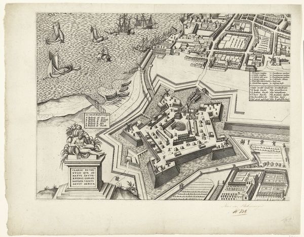
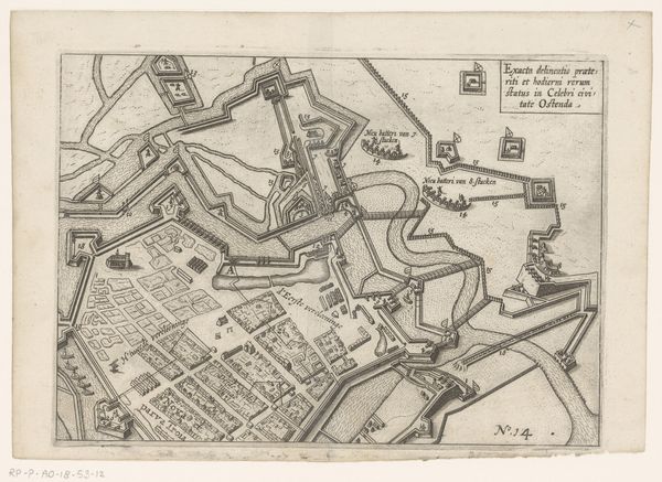
This is an anonymous birds-eye view of Heusden, rendered in ink. Note the town's fortifications, star-shaped, bristling with defensive points. This configuration is no mere engineering solution; it’s a powerful symbol of protection, a motif stretching back to ancient fortifications. Consider the Babylonian city walls, or even the layered defenses of a medieval castle. The impulse to fortify, to create a safe haven, echoes through time. This drive isn’t just practical; it's deeply rooted in our psyche. We see it manifested in the protective gestures of a mother, the construction of a secure home, or even the carefully guarded boundaries of personal space. The star-shaped fort, therefore, speaks to a primal desire for safety and order in a chaotic world. It is a pattern of defense, a symbol that resurfaces throughout history, adapting to new technologies and anxieties, always reminding us of our enduring need for security.
Comments
No comments
Be the first to comment and join the conversation on the ultimate creative platform.
More like this