About this artwork
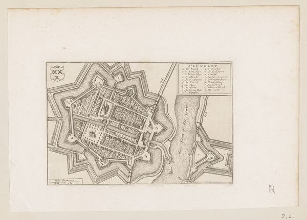
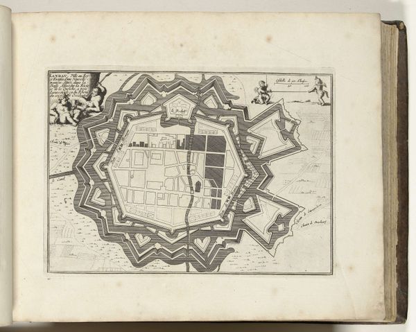
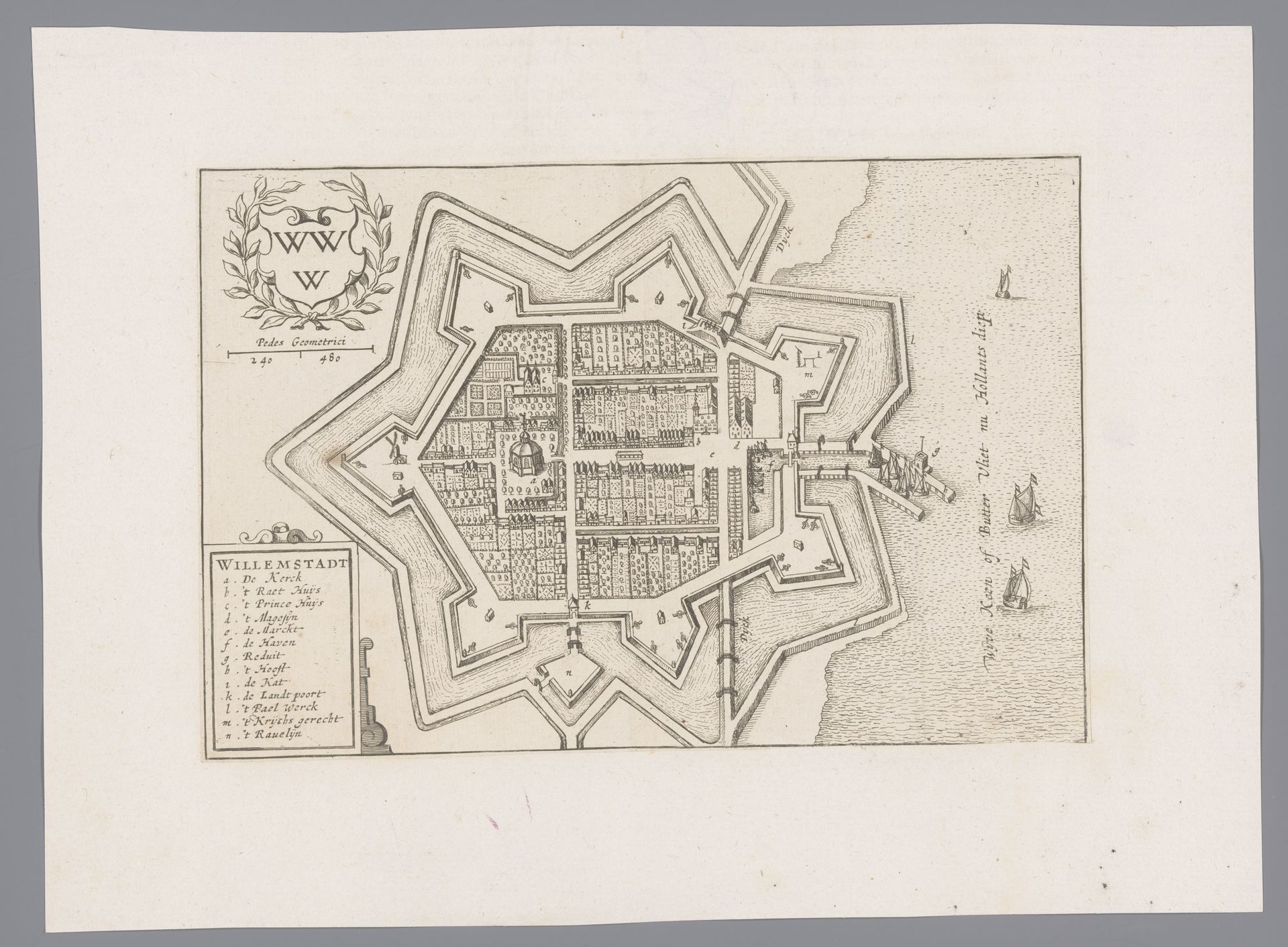
This is an undated map of Willemstad, likely made in the 17th century and printed using an engraving. Looking at the image, we see a bird's-eye view of the city, encircled by elaborate fortifications. The star shape isn't arbitrary; it's a deliberate military design, intended to provide defensive firing positions to protect the city from attack. Made in the Netherlands, a major center for cartography during this period, this map reflects the Dutch Republic's preoccupation with trade and defense. Maps weren't just navigational tools; they were symbols of power and control. The Dutch invested heavily in infrastructure, and this map celebrates the technological and administrative prowess of the state. It suggests the social conditions that shaped its production: a wealthy, urbanized society with a strong mercantile class. To fully appreciate this map, we might consult period military treatises and city planning documents, to understand the science behind the fortifications and grasp the relationship between the city's physical structure and its social life.
Artwork details
- Medium
- print, engraving
- Dimensions
- height 146 mm, width 221 mm
- Location
- Rijksmuseum
- Copyright
- Rijks Museum: Open Domain
Tags
Comments
Share your thoughts
About this artwork
This is an undated map of Willemstad, likely made in the 17th century and printed using an engraving. Looking at the image, we see a bird's-eye view of the city, encircled by elaborate fortifications. The star shape isn't arbitrary; it's a deliberate military design, intended to provide defensive firing positions to protect the city from attack. Made in the Netherlands, a major center for cartography during this period, this map reflects the Dutch Republic's preoccupation with trade and defense. Maps weren't just navigational tools; they were symbols of power and control. The Dutch invested heavily in infrastructure, and this map celebrates the technological and administrative prowess of the state. It suggests the social conditions that shaped its production: a wealthy, urbanized society with a strong mercantile class. To fully appreciate this map, we might consult period military treatises and city planning documents, to understand the science behind the fortifications and grasp the relationship between the city's physical structure and its social life.
Comments
Share your thoughts