drawing, print, pen, architecture
#
architectural sketch
#
drawing
# print
#
old engraving style
#
architectural drawing
#
pen work
#
architecture drawing
#
pen
#
cityscape
#
architecture
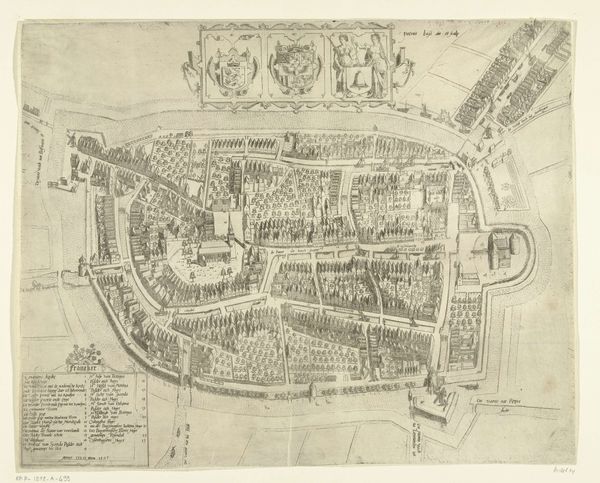
Dimensions: height 176 mm, width 216 mm
Copyright: Rijks Museum: Open Domain
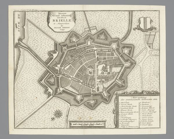
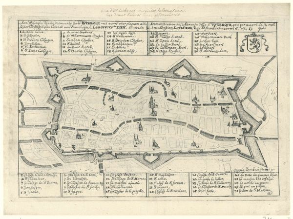
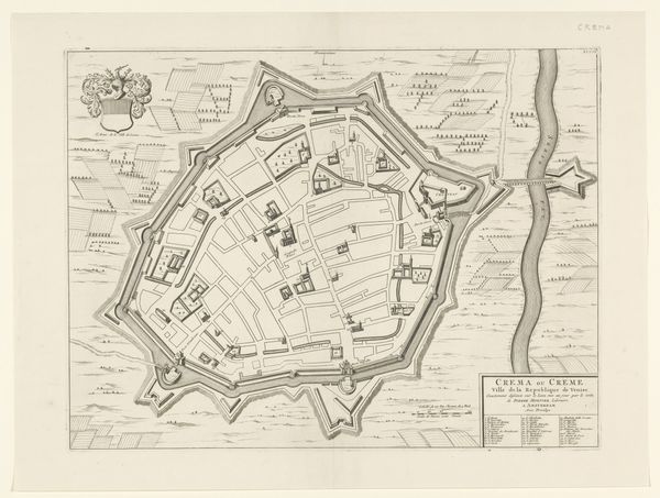
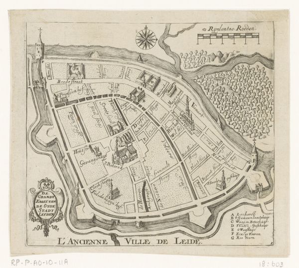
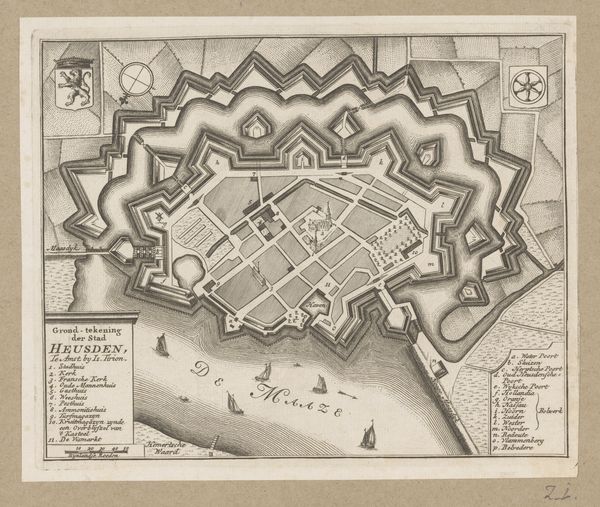
Curator: This detailed “Plattegrond van Geertruidenberg," created in 1747 by an anonymous artist, offers a bird's-eye view of the city's layout, meticulously rendered with pen and ink. Editor: It feels strangely calm, even static. There’s no sense of life bustling through the streets, despite all that careful linework suggesting architectural specificity. The elaborate fortifications, rendered so meticulously, have an ominous weight about them. Curator: The geometric precision of the city plan is captivating. Note how the fortifications form a complex network, effectively dictating the negative space around the central hub, the “Markt." There's such control in the formal arrangement. Editor: I see control, but also a social hierarchy embedded in that very planning. The fortifications aren’t merely aesthetic, but physical assertions of power and exclusion. The surrounding water acts as a barrier, dividing the "safe" urban space from the "untamed" nature. Who was really meant to feel at home within those lines? Curator: Undoubtedly the drawing highlights prevailing anxieties around safety. Yet consider how the pen work, particularly the cross-hatching to denote shadows and textures, offers subtle gradations within the rigorous composition. The technique adds an illusion of three-dimensionality. Editor: Yes, technique serves ideology here. By elevating the structural components of Geertruidenberg into an artistic object, it becomes less about lived space, and more a projection of an ideal, controlled, and inherently unequal environment. This rendering serves the authorities, not the inhabitants. Curator: Perhaps so, yet through purely formal analysis, it remains an interesting demonstration of spatial representation techniques. Editor: To me, it’s an archive of a system. But I find such careful drawings haunting for how clearly they convey what's often left unspoken: power structures solidified by lines and walls.
Comments
No comments
Be the first to comment and join the conversation on the ultimate creative platform.
More like this