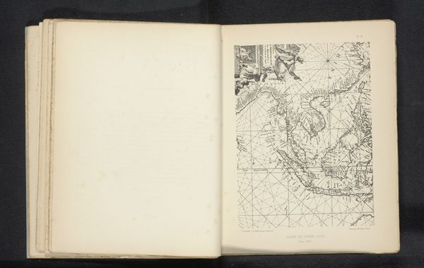
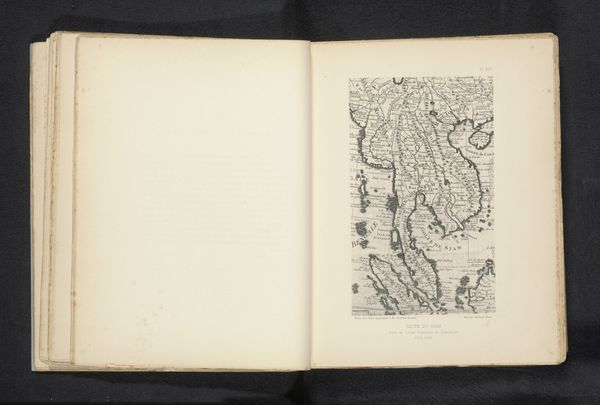
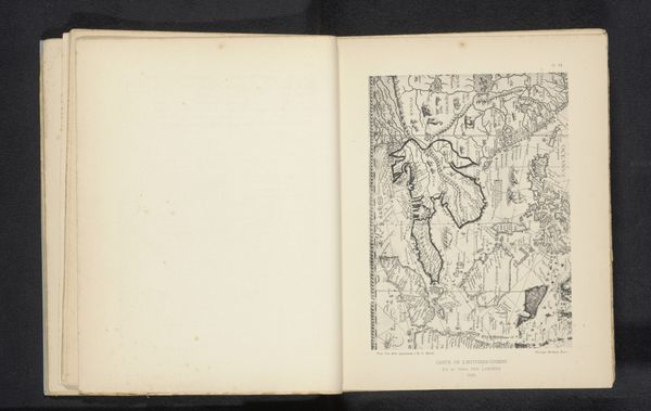
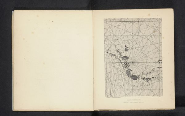
Reproductie van een landkaart van de omgeving van Thailand en Cambodja uit een atlas door Johannes Janssonius before 1895
0:00
0:00
graphic-art, print, engraving
#
graphic-art
#
aged paper
#
script typography
# print
#
asian-art
#
sketch book
#
hand drawn type
#
personal sketchbook
#
hand-drawn typeface
#
fading type
#
line
#
pen work
#
sketchbook drawing
#
sketchbook art
#
engraving
Dimensions: height 202 mm, width 124 mm
Copyright: Rijks Museum: Open Domain
This is Michel Berthaud’s reproduction of Johannes Janssonius's map of Thailand and Cambodia. Berthaud, born in 1845, created this map at a time of intense European colonial expansion in Southeast Asia. Cartography has always been deeply intertwined with power. Maps, seemingly objective, are in fact laden with the values and agendas of their creators. Janssonius’s original map, reproduced here, reflects a European perspective on Southeast Asia, defining territories and resources through a colonial lens. Berthaud's reproduction comes at a moment in France where debates around colonial expansion were rife. Consider how the map flattens complex cultural and political landscapes into a set of lines and names. The act of mapping, therefore, becomes an act of claiming, an assertion of dominance. How do such maps shape our understanding of these regions and the people who inhabit them? How does this historical representation influence contemporary relationships between the West and Southeast Asia? This image invites us to reflect on the legacy of colonialism and its enduring impact on identity, place, and power.
Comments
No comments
Be the first to comment and join the conversation on the ultimate creative platform.
More like this