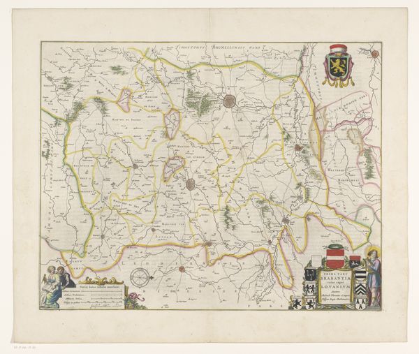
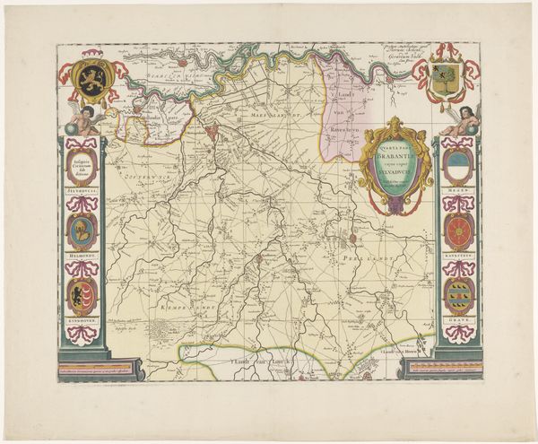
Kaart van het kwartier van Antwerpen, onderdeel van het hertogdom Brabant 1638 - 1711
0:00
0:00
print, engraving
#
baroque
# print
#
cityscape
#
history-painting
#
engraving
#
watercolor
Dimensions: height 413 mm, width 508 mm
Copyright: Rijks Museum: Open Domain
Editor: This is a beautifully detailed print, "Kaart van het kwartier van Antwerpen, onderdeel van het hertogdom Brabant"—or, “Map of the quarter of Antwerp, part of the Duchy of Brabant." It dates from between 1638 and 1711. The engraving is lovely and complex! What really strikes me is the incredible precision involved in making this kind of historical record; what catches your eye about this piece? Curator: For me, it's like peering through time itself. These maps are far more than geographic documents; they're narratives of power, ambition, and artistry. Think about it: someone meticulously etched this, committing not just landscapes to copper, but political realities too. Those borders, colored with such care, represent dominion and desire. Isn't it incredible to consider the intent behind each line, each name? The embellishments, almost whimsical at first glance, are actually coded declarations of authority! Editor: Right, I can see that, especially with the crests! So, they’re using art as a kind of propaganda, then? Curator: Absolutely, though perhaps "persuasion" is a softer way to phrase it. And let’s not forget the practical application. Before GPS, imagine relying on *this* to navigate, to plot military campaigns or trade routes. Do you notice the strategic placement of Antwerp within this intricate web of territories? It’s a subtle assertion of the city's importance, a whisper of dominance within the Duchy. Editor: That’s fascinating! I had just seen a pretty map; I totally missed the power play baked into the lines. It really makes you wonder what stories old maps like these are trying to tell. Curator: Precisely. It’s a testament to how art, even in its most seemingly functional forms, always reflects a deeper story. Now, how would we translate all these layers to today's audience?
Comments
No comments
Be the first to comment and join the conversation on the ultimate creative platform.
More like this