print, engraving
# print
#
perspective
#
cityscape
#
northern-renaissance
#
engraving
Dimensions: height 367 mm, width 439 mm
Copyright: Rijks Museum: Open Domain
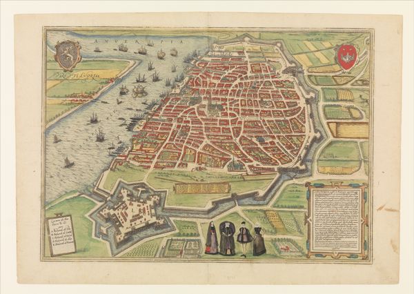
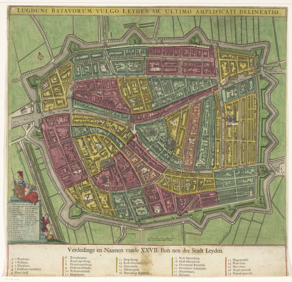
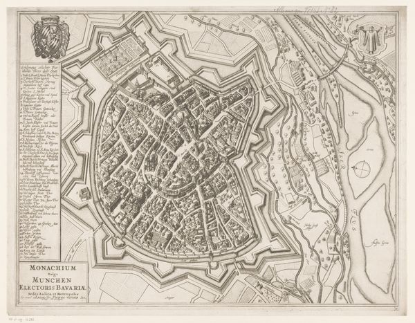
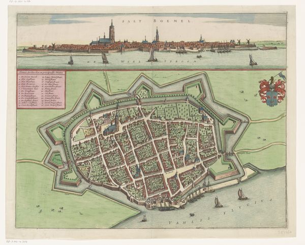
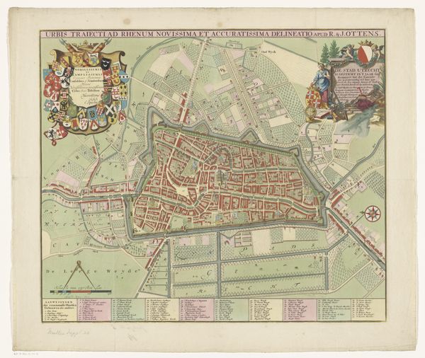
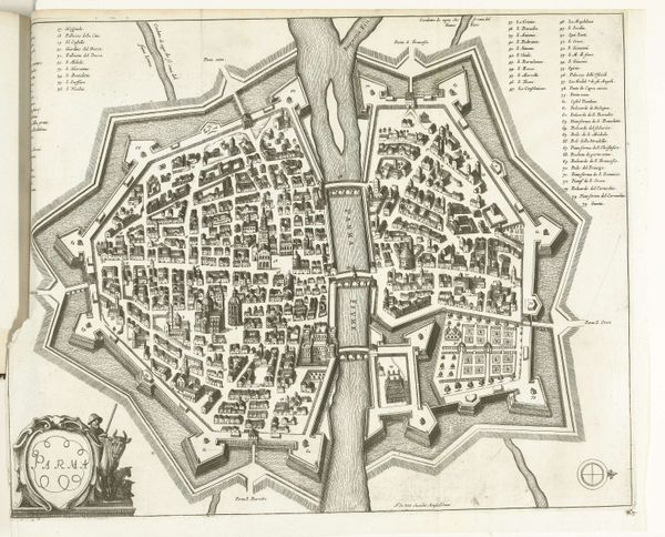
This is Frans Hogenberg's "Plattegrond van Doornik," an engraving offering a bird's eye view of the city, made around the late 16th century. Dominating the scene is the city's fortified wall. The wall itself is a potent symbol, a protective embrace representing security and order, but it also speaks of division and exclusion. This archetype echoes across time, from the walls of Jericho to the Great Wall of China. We see the same psychological need for protection and demarcation expressed in countless human endeavors. Consider how the concept of the wall has evolved. Originally a physical barrier against outside threats, it now exists in myriad forms: national borders, social boundaries, even the walls we build around ourselves emotionally. This cartographic representation, then, transcends its literal depiction of Doornik, becoming a mirror reflecting our collective anxieties and desires for safety, control, and belonging. The image holds an emotional charge, engaging our subconscious understanding of what it means to be protected and confined. As it resurfaces through history, the wall has evolved, accruing new layers of meaning and resonating with our deepest fears and aspirations.
Comments
No comments
Be the first to comment and join the conversation on the ultimate creative platform.
More like this