print, engraving
dutch-golden-age
geometric
line
cityscape
engraving
Dimensions: height 250 mm, width 293 mm
Copyright: Rijks Museum: Open Domain
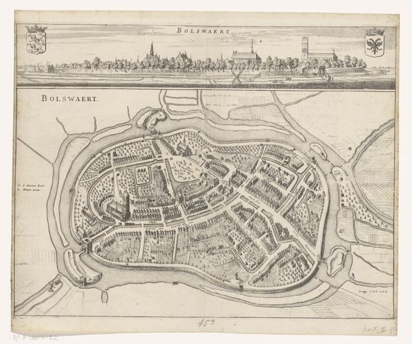
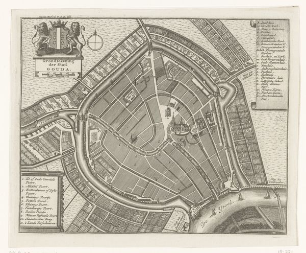
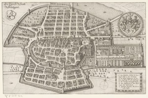
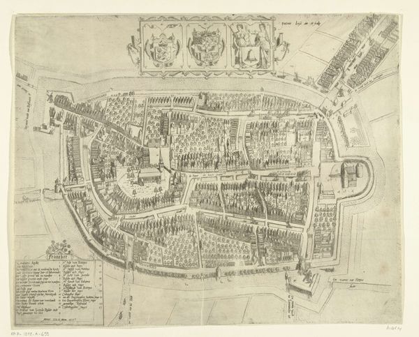
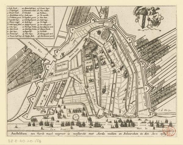
Pieter Hendricksz. Schut made this print of Amsterdam in 1585. It shows how the city looked after its fourth expansion, fortified with earthen walls and bulwarks. Looking at this image, we can see how Amsterdam was consciously shaping its urban landscape for defense and trade. The fortifications, clearly visible, reflect the city's strategic importance during the Eighty Years' War. Amsterdam was a key player in the Dutch Revolt against Spanish rule, and its urban planning was deeply intertwined with its political and economic ambitions. The grid-like structure within the fortifications speaks to the city’s burgeoning merchant class and their need for efficient organization. Historical maps, such as this one, offer us a snapshot of a specific moment in time. Comparing this map with others from different periods, consulting city archives, and studying the records of the institutions would provide invaluable insights into Amsterdam's evolution and the forces that shaped it.
Comments
No comments
Be the first to comment and join the conversation on the ultimate creative platform.