print, paper
baroque
paper
cityscape
history-painting
soft colour palette
Dimensions: height 412 mm, width 521 mm
Copyright: Rijks Museum: Open Domain
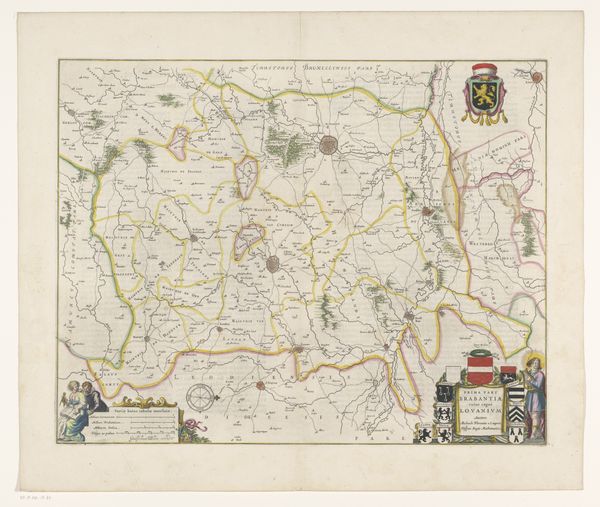
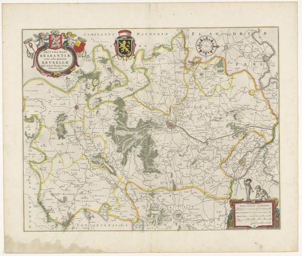
This is an anonymous map of the Leuven quarter of the Duchy of Brabant. Notice the heraldic symbols prominently displayed. Coats of arms—these emblems of family and state—are more than mere decoration. They are containers of cultural memory, each line, color, and beast deliberately chosen to signify lineage, power, and allegiance. The lion rampant, often seen on these shields, is a primal symbol of courage and nobility, echoing across centuries from ancient bestiaries to medieval banners. Consider how these symbols resonate differently through time. The lion, once a straightforward assertion of valor, becomes in later eras a complex signifier of national identity, fraught with political and emotional weight. It's a dance of continuity and change, a testament to the enduring power of symbols to evoke collective memories and shape our understanding of the world.
Comments
No comments
Be the first to comment and join the conversation on the ultimate creative platform.