drawing, print, etching, paper, ink
#
drawing
#
dutch-golden-age
# print
#
etching
#
landscape
#
paper
#
ink
#
cityscape
#
genre-painting
#
watercolor
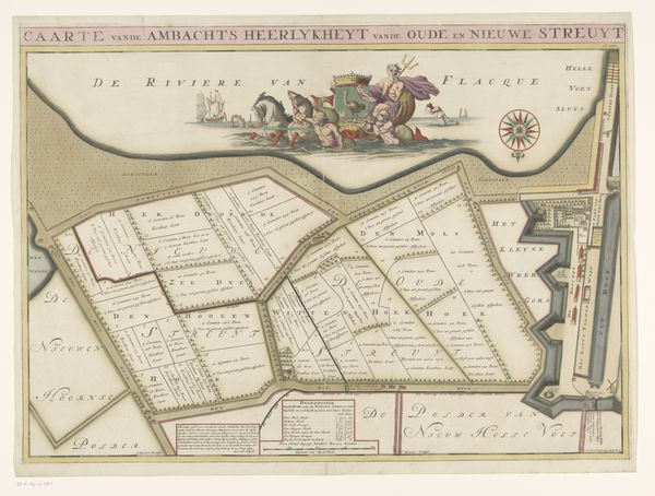
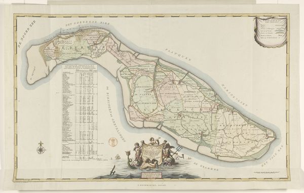
Dimensions: height 676 mm, width 1190 mm
Copyright: Rijks Museum: Open Domain
Bastiaen Stopendael rendered this map of Alblasserwaard and Vijfheerenlanden in ink, around the latter half of the 17th century. Note the prominent compass rose, a universal symbol of navigation and orientation. Its presence speaks to humanity's timeless quest for direction, mirroring the celestial rose windows in Gothic cathedrals, which charted the heavens and guided the soul. Consider the waterways meticulously drawn, each a lifeline connecting communities and commerce. Water, a potent symbol of life and purification, flows as it did in ancient Mesopotamian art where rivers were depicted as divine sources of abundance. Rivers, both literal and symbolic, have served as arteries of culture, carrying ideas and innovations across continents. Even in the most pragmatic renderings of land, we find echoes of our deepest desires. A map is not merely a depiction of space, but a reflection of our will to understand and control the world around us.
Comments
No comments
Be the first to comment and join the conversation on the ultimate creative platform.
More like this