drawing, print, paper
#
drawing
# print
#
paper
#
geometric
#
orientalism
#
line
#
cityscape
Dimensions: height 447 mm, width 568 mm
Copyright: Rijks Museum: Open Domain
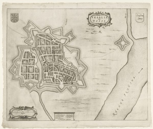
This undated map, titled "Plattegrond van Algiers," offers a look at the city of Algiers through the lens of colonial cartography. Created by an anonymous author, the map presents a detailed layout of the city's urban structures and coastal fortifications. Consider how maps like these were not just neutral representations of space, but tools wielded by colonial powers. They were used to assert dominance, control resources, and reshape landscapes. The city’s design is presented in a way that facilitates surveillance and control by the colonizers. What is not represented tells a story of its own. The absence of indigenous perspectives and the erasure of local narratives underscore the power dynamics inherent in colonial projects. Ultimately, this map serves as a poignant reminder of the intertwined histories of colonization, representation, and power. It prompts us to reflect on the legacy of colonialism and its enduring impact on shaping identities, spaces, and narratives.
Comments
No comments
Be the first to comment and join the conversation on the ultimate creative platform.
More like this