Historische kaart van Nederland met de gebieden van de Bataven en Friezen 1697 - 1725
0:00
0:00
print, engraving
# print
#
pen illustration
#
geometric
#
history-painting
#
engraving
Dimensions: height 317 mm, width 420 mm
Copyright: Rijks Museum: Open Domain
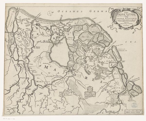
Gerrit de Broen created this historical map of the Netherlands, featuring the regions of the Batavi and Frisians, sometime between 1659 and 1740. During this period, mapmaking was not merely a scientific endeavor but also a political act, asserting territorial claims and cultural identities. This map reflects the seventeenth and early eighteenth-century Dutch Republic’s preoccupation with its historical roots. The depiction of the Batavi and Frisians, ancient peoples who resisted Roman rule, served as a powerful narrative. It promoted the idea of a long-standing tradition of Dutch independence and self-governance. The glorification of these ancestral figures was a way to legitimize the Dutch Republic's own struggle for freedom against Spanish rule. This map uses cartography to assert cultural pride, linking the contemporary Dutch identity with an idealized vision of its past.
Comments
No comments
Be the first to comment and join the conversation on the ultimate creative platform.
More like this