drawing, print, paper, ink, engraving
#
drawing
# print
#
paper
#
ink
#
geometric
#
cityscape
#
engraving
Dimensions: height 50 mm, width 40 mm
Copyright: Rijks Museum: Open Domain
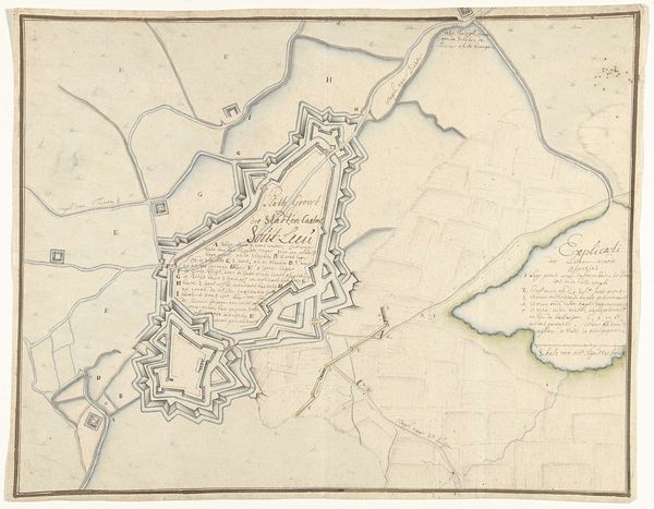
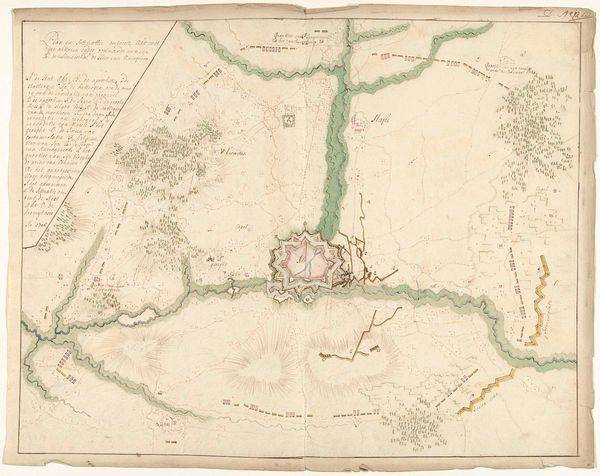
This Ex libris, made by an anonymous artist, shows a bird’s eye view of a town, maybe made with ink or watercolour. The thin lines remind me of the way we sketch, feeling our way into an image. Look closely at the outer fortifications, they create this starburst effect. It’s such an interesting way of seeing the world, from above, imposing order. There’s something both aggressive and strangely beautiful about that shape. It gives the whole map this kind of energy, like a contained explosion. I am thinking of the way Paul Klee plays with space in his paintings. This isn’t just about factual representation; it’s about how we perceive and shape our environment, how we try to control it, and how art captures that struggle. It's a reminder that every line, every decision, is a reflection of our own way of seeing.
Comments
No comments
Be the first to comment and join the conversation on the ultimate creative platform.
More like this