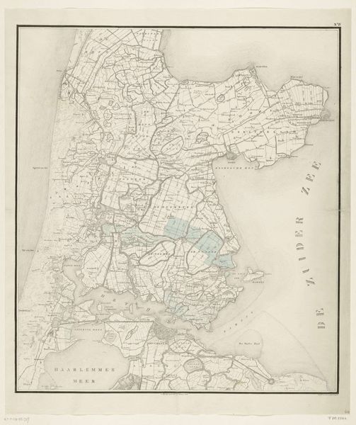
Kaart van dat gedeelte der Provincie Overijssel, het welk bij den Jongsten Watersnood, op den 4 & 5 Februarij 1825, geheel is overstroomd geweest (...) 1826
0:00
0:00
graphic-art, print, engraving
#
graphic-art
#
dutch-golden-age
# print
#
landscape
#
engraving
Dimensions: height 1045 mm, width 875 mm
Copyright: Rijks Museum: Open Domain
This map by C. van Baarsel en Zoon depicts the areas of the Province Overijssel that were flooded in the disastrous North Sea flood of February 1825. This event was a watershed moment in Dutch history, revealing the vulnerabilities of a society intimately tied to its waterways. Mapping was not merely a scientific endeavor; it was a deeply political act. How land is depicted, and who has access to that information, shapes power dynamics and resource distribution. Look closely at the details; consider the lives and livelihoods disrupted by the flood. How does this map not only document a disaster, but also serve as a tool for recovery and resilience? The emotional weight of such events lingers long after the waters recede. This map invites reflection on our relationship with the environment, and the ongoing effort to negotiate safety, identity, and belonging in a world shaped by water.
Comments
No comments
Be the first to comment and join the conversation on the ultimate creative platform.
More like this