About this artwork
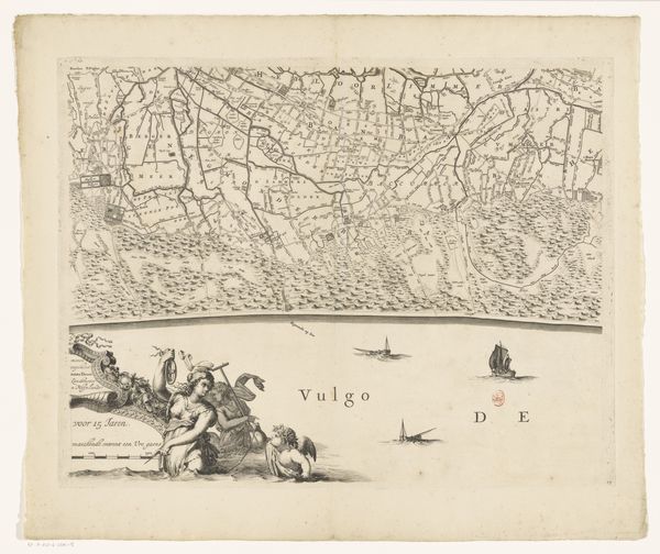
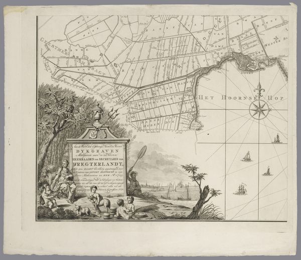
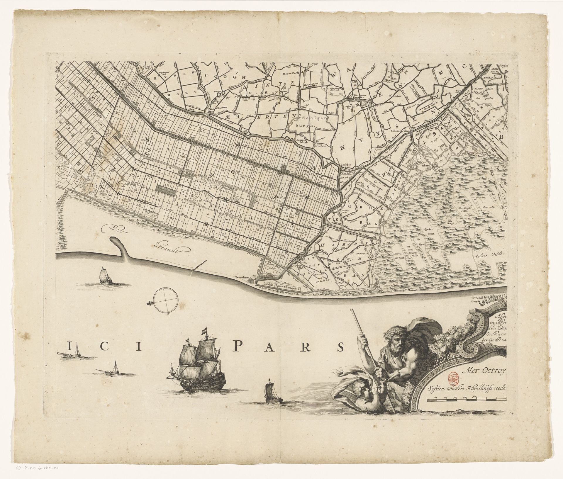
Curator: Welcome. We’re standing before “Kaart van Kennemerland en West-Friesland (veertiende deel),” a fascinating print created around 1680 by Coenraet Decker. Editor: My first impression is of order. It's a landscape transformed into precise geometry, yet softened by the wisps of ships and a dynamic sea creature. There's a tension there between control and the untamed. Curator: Indeed. Maps like this weren't merely geographical tools; they were potent symbols of Dutch mastery over their environment. Land reclamation was a major source of wealth and power, shaping both their literal and metaphorical landscape. Notice how the depicted region is carefully delineated and ordered. The Dutch saw themselves as bringing civility and rationality to the natural world. Editor: That rational order certainly permeates the work’s design. The composition divides almost perfectly into quadrants, and the sharp linear elements highlight each district's borders. There is a hierarchy as well: with decorative mythological sea figures relegated to the lower right. How would these have functioned symbolically for the Dutch Golden age audience? Curator: Well, images like these, though decorative, resonated with deeply embedded cultural understandings. These mythological figures represented power over water, alluding to the ever-present threat and simultaneous economic dependence of the Netherlands on the seas. Such images linked contemporary achievements in land management to classical notions of power. It suggested that the Dutch, too, were inheritors of this tradition. Editor: You can clearly feel the economic currents in the crisp execution, careful typography, and detailed bordering. Even the compass serves to show navigation and, symbolically, their ambitions as explorers. Curator: Absolutely. This print provides an opportunity to reflect on the layers of meaning a single image can carry. Editor: A map becomes much more than simply way-finding when its formal qualities combine with cultural symbols. It reveals deep-seated aspirations of a society. Curator: Precisely, a beautiful meeting of form and cultural force. Editor: The artist deftly combined those components to craft an enduring record.
Kaart van Kennemerland en West-Friesland (veertiende deel)
1680
Coenraet Decker
1650 - 1685Location
RijksmuseumArtwork details
- Medium
- drawing, print, etching, ink, engraving
- Dimensions
- height 451 mm, width 580 mm
- Location
- Rijksmuseum
- Copyright
- Rijks Museum: Open Domain
Tags
Comments
Share your thoughts
About this artwork
Curator: Welcome. We’re standing before “Kaart van Kennemerland en West-Friesland (veertiende deel),” a fascinating print created around 1680 by Coenraet Decker. Editor: My first impression is of order. It's a landscape transformed into precise geometry, yet softened by the wisps of ships and a dynamic sea creature. There's a tension there between control and the untamed. Curator: Indeed. Maps like this weren't merely geographical tools; they were potent symbols of Dutch mastery over their environment. Land reclamation was a major source of wealth and power, shaping both their literal and metaphorical landscape. Notice how the depicted region is carefully delineated and ordered. The Dutch saw themselves as bringing civility and rationality to the natural world. Editor: That rational order certainly permeates the work’s design. The composition divides almost perfectly into quadrants, and the sharp linear elements highlight each district's borders. There is a hierarchy as well: with decorative mythological sea figures relegated to the lower right. How would these have functioned symbolically for the Dutch Golden age audience? Curator: Well, images like these, though decorative, resonated with deeply embedded cultural understandings. These mythological figures represented power over water, alluding to the ever-present threat and simultaneous economic dependence of the Netherlands on the seas. Such images linked contemporary achievements in land management to classical notions of power. It suggested that the Dutch, too, were inheritors of this tradition. Editor: You can clearly feel the economic currents in the crisp execution, careful typography, and detailed bordering. Even the compass serves to show navigation and, symbolically, their ambitions as explorers. Curator: Absolutely. This print provides an opportunity to reflect on the layers of meaning a single image can carry. Editor: A map becomes much more than simply way-finding when its formal qualities combine with cultural symbols. It reveals deep-seated aspirations of a society. Curator: Precisely, a beautiful meeting of form and cultural force. Editor: The artist deftly combined those components to craft an enduring record.
Comments
Share your thoughts