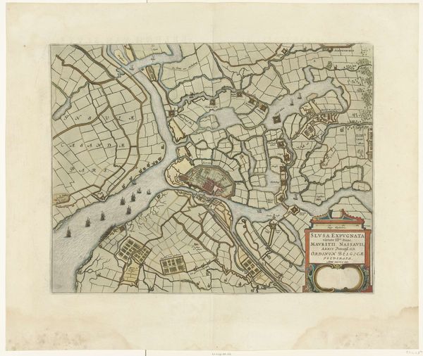
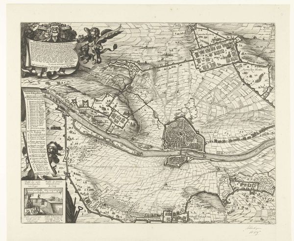
Kaart met beleg en verovering van Schenkenschans door Frederik Hendrik, 1635-1636 before 1652
0:00
0:00
claesjanszvisscher
Rijksmuseum
drawing, print, engraving
#
drawing
# print
#
pen sketch
#
line
#
cityscape
#
history-painting
#
engraving
Dimensions: height 473 mm, width 572 mm
Copyright: Rijks Museum: Open Domain
Editor: So, here we have a map titled "Kaart met beleg en verovering van Schenkenschans door Frederik Hendrik, 1635-1636," created by Claes Jansz. Visscher before 1652. It looks like an engraving, almost a pen sketch really, and it details a cityscape during a historical event. It’s incredibly detailed and precise. What exactly am I looking at here, beyond just the lines? Curator: You're looking at far more than just lines. This isn’t simply a map, it's a potent piece of historical representation, carefully designed for public consumption. Consider the context: the Dutch Republic was at war with Spain, fighting for its independence. These meticulously crafted prints weren't just navigational tools. They were instruments of propaganda, celebrating Dutch military successes and shaping public opinion. How do you think this kind of imagery might have impacted people's perception of the war? Editor: Well, I suppose seeing such a detailed, seemingly objective depiction of a siege might make it feel more real, more important. The inclusion of, like, tiny figures of soldiers gives it a sense of action, even if it’s static. It also conveys power and control, I guess, highlighting the Dutch ability to conquer. Curator: Precisely. Visscher isn't just showing *what* happened, but also framing *how* it was perceived. Notice how the landscape is meticulously rendered, almost idealized, turning a brutal conflict into an exercise in skillful execution. Consider, too, where such prints might have been displayed: in wealthy homes, civic buildings… reinforcing a sense of national pride and legitimizing the war effort for elite audiences. But, is it entirely neutral in its depiction? Editor: I'm guessing not. It almost seems to highlight the "order" imposed by the Dutch on what was likely chaotic reality. The precise lines and organization lend an air of authority to the Dutch conquest, almost like they were destined to win. Curator: Exactly! Which highlights how the seemingly simple medium of a printed map becomes a carrier of complex socio-political meaning. Editor: Wow, I hadn’t thought about a map carrying such weight, literally making a political statement. It shifts how I view similar pieces going forward. Curator: Indeed. Art often plays a significant public role and influences our perceptions and understanding of history.
Comments
No comments
Be the first to comment and join the conversation on the ultimate creative platform.
More like this