drawing, print, etching, engraving
#
drawing
#
dutch-golden-age
# print
#
etching
#
old engraving style
#
landscape
#
etching
#
cityscape
#
engraving
Dimensions: height 498 mm, width 357 mm
Copyright: Rijks Museum: Open Domain
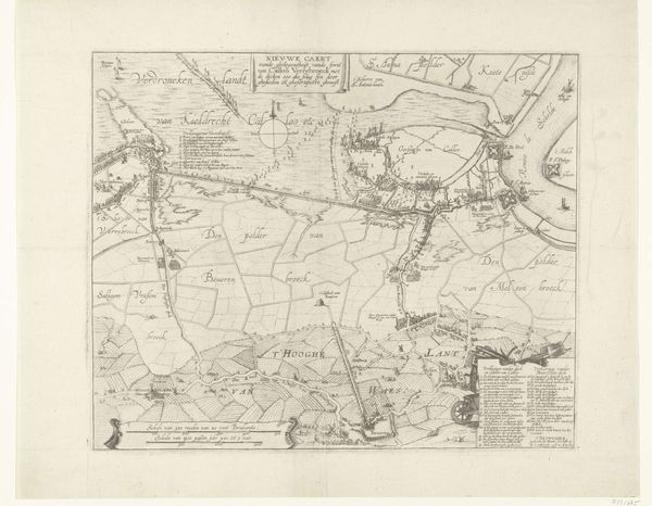
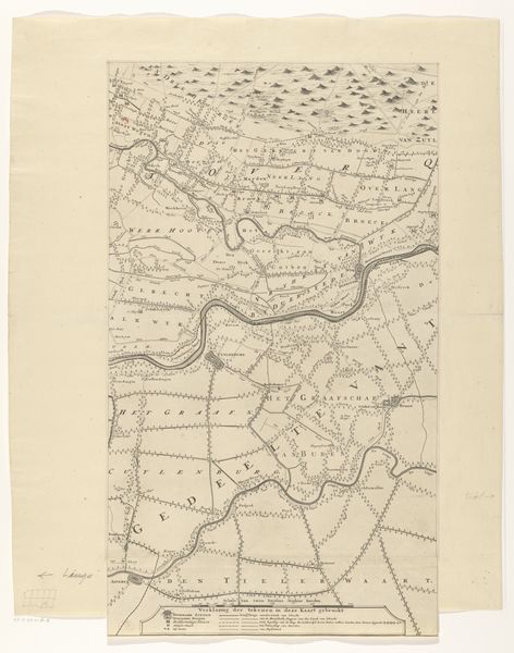
Editor: Here we have "Kaart van de Maas van Rotterdam tot de Noordzee (derde deel)," or "Map of the Meuse River from Rotterdam to the North Sea (third part)." It's a drawing from between 1666 and 1740 by Joost van Geel, rendered through etching and engraving. It gives the sense of peering into another world, both familiar and foreign, like an ancient video game map! What are your immediate impressions? Curator: It's intriguing, isn't it? More than just a cartographic document, it's almost like a portrait of a relationship - the dance between people and the landscape. Do you notice how the cultivated land is precisely gridded? Like humanity trying to impose order onto nature's wildness? Makes you wonder, doesn’t it, what narratives lie hidden within those lines and fields. Editor: It does make you think. All those straight lines representing fields, and then the winding, unpredictable river… Did maps like these serve more than just a practical function at the time? Curator: Absolutely. Think about it: this map wasn't just showing people *how* to get somewhere. It was a statement. It spoke of ownership, of dominion. In that Golden Age of Dutch painting, wouldn't claiming space also serve as claiming power? Also, notice how artfully those ships are rendered on the water. It becomes almost symbolic, a narrative where nature is a place, rather than an experience. What do you make of it? Editor: I never really thought about a map having… attitude. Now that you point it out, the level of detail really emphasizes human influence on the land. It's fascinating how much it communicates! Curator: Precisely! Art hides in the strangest of places. Who would expect it in cartography, right?
Comments
No comments
Be the first to comment and join the conversation on the ultimate creative platform.
More like this