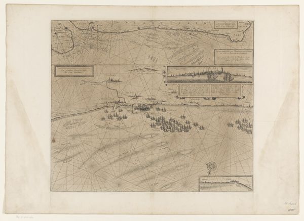
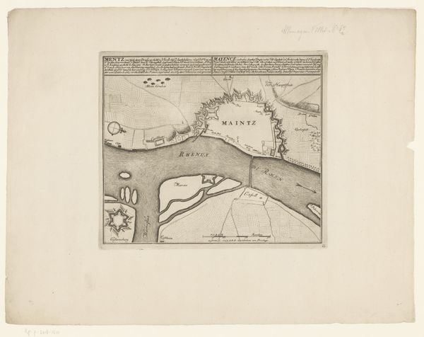
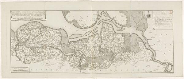
Kaart van de herovering van Zoutleeuw door de geallieerden, 1705 1705 - 1717
0:00
0:00
anonymous
Rijksmuseum
print, engraving
#
baroque
# print
#
landscape
#
cityscape
#
engraving
Dimensions: height 394 mm, width 461 mm
Copyright: Rijks Museum: Open Domain
This map of Zoutleeuw was made in 1705 by an anonymous artist, using the technique of etching. The fine lines and intricate details were achieved by drawing into a wax-coated metal plate, which was then submerged in acid. The acid bit away the exposed lines, creating grooves that would hold ink, and then be transferred to paper. As a method, etching allowed for the relatively easy reproduction of images on paper. The labor of the artist would be multiplied, and distributed widely. In this case, that labor served a clear political purpose: to document the recapture of Zoutleeuw by allied forces during the War of the Spanish Succession. The map emphasizes the strategic layout of the town, the disposition of troops, and the course of battle. In this way, the image participated in a wider effort to shape public understanding of the conflict, turning warfare into an item of consumption. Consider how the materials, making, and context intertwine to give this artwork its full significance, blurring the boundaries between fine art, craft, and propaganda.
Comments
No comments
Be the first to comment and join the conversation on the ultimate creative platform.
More like this