drawing, print, paper
#
drawing
# print
#
asian-art
#
landscape
#
paper
#
geometric
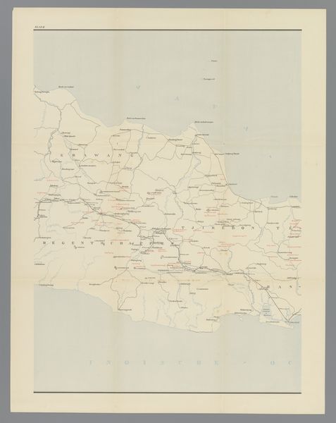
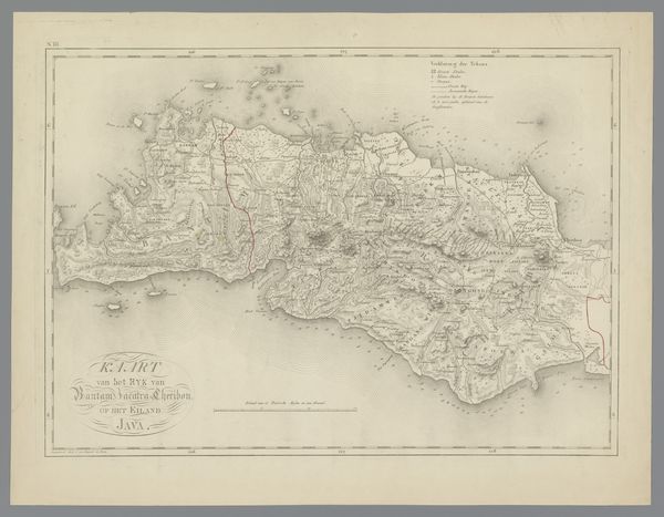
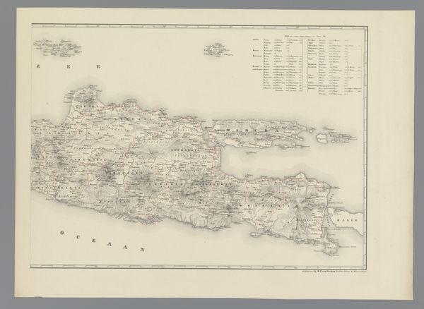
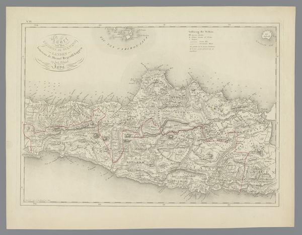
Dimensions: height 672 mm, width 522 mm
Copyright: Rijks Museum: Open Domain
Editor: We’re looking at "Kaart van west en midden Java, linkerdeel," a map of West and Central Java created between 1890 and 1891 by an anonymous artist. It’s a drawing and print on paper, housed here at the Rijksmuseum. It has a sort of faded, antique beauty, like a treasure map. What jumps out at you when you see it? Curator: The past whispering, mostly. All maps are lies of course, necessary ones – delicious ones! – but this one in particular seems so steeped in a particular point of view. Not just geographical, but historical, political... You can almost smell the ink drying, feel the hand that meticulously drafted each line, each placename. It's more than just land; it’s a story being told, isn't it? One perhaps that they wanted everyone to know! I wonder about what parts of the story they felt were safe to leave out, to hide? What isn't drawn in but still existed, do you know? Editor: Absolutely! I see the Dutch titles and locations, hinting at colonial influence. Do you think the aesthetic choices – the faded colours, the specific style of typography – were intentional in shaping that narrative? Curator: Intentionality is the spice of history, isn't it? Certainly, this was made with the Dutch looking at what was “theirs”, charting and measuring. All of this precision served as justification, somehow... Each carefully placed line could represent a claim, an assertion of control, but perhaps a deep misunderstanding, too? Maps are such powerful forms of language, wouldn't you agree? It leaves one yearning to be on the boat approaching land for the first time. Can you imagine seeing it all from that perspective? Editor: It's interesting to consider how maps can be so objective and subjective simultaneously. I will surely give that more thought! Curator: That's the paradox of art, really - isn't it? Holding both the seen and the unseen within its frame.
Comments
No comments
Be the first to comment and join the conversation on the ultimate creative platform.
More like this