# print
#
asian-art
#
geometric
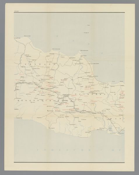
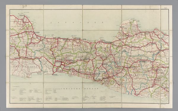
Dimensions: height 672 mm, width 523 mm
Copyright: Rijks Museum: Open Domain
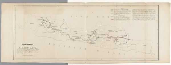
Curator: At the Rijksmuseum, we're standing before an intriguing print titled 'Kaart van west en midden Java, rechterdeel,' created anonymously between 1890 and 1891. Editor: My first impression is of faded order—a geometric arrangement that evokes the feel of a palimpsest. All those names…do they tell of past inhabitants? Curator: Absolutely. The very act of mapping is never neutral; it imposes a certain vision, a claiming of space, wouldn’t you agree? The print details the western and central regions of Java, offering insight into geographical knowledge and perhaps also, the power structures of the era. Look closely. How might that relate to cultural narratives and identities? Editor: Precisely. Notice how line quality divides the whole. Observe the topography, the scale of cities noted in contrast to natural elements, even the color palette with subtle shifts delineating the lay of the land. These details underscore a conscious effort to classify and impose order. The different orientations give some insight into how spaces can be viewed and used. What stories are implicitly privileged here? Curator: Consider that the map likely served specific colonial administrative functions. Red markings, for instance, might indicate areas of strategic or economic interest to the colonizers. Mapping in this style had a large impact on spatial representation, codifying territory to suit western modes of thinking, overlooking indigenous understandings. Editor: I'd never considered the subtle force a two-dimensional printed object like this can exert, fixing in time relationships of power and knowledge. I see how Asian art and culture are geometrically defined here. Curator: Indeed. These visualizations contribute to an ongoing historical dialogue between cartography and culture, each impacting the other over decades. What a layered reminder that the power to name is itself power, etched in time. Editor: Ultimately, observing how it all comes together in front of me today makes for a new reading into an artifact about an attempt at an earlier understanding. I guess what remains are only subjective attempts.
Comments
No comments
Be the first to comment and join the conversation on the ultimate creative platform.
More like this