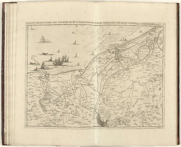
drawing, print, paper, ink, engraving
#
drawing
#
baroque
#
pen drawing
# print
#
landscape
#
paper
#
ink
#
cityscape
#
engraving
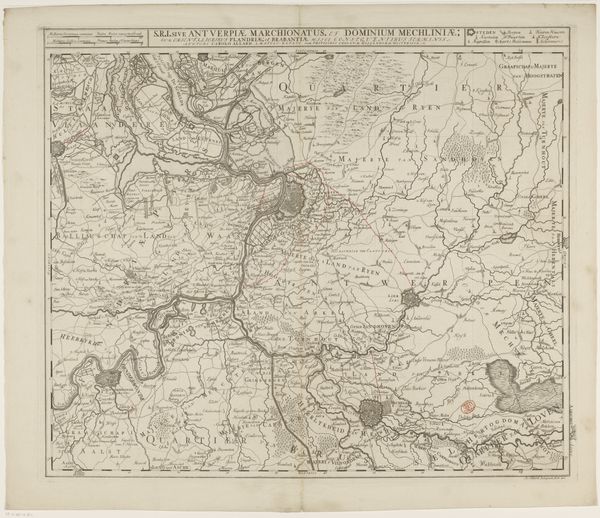
Dimensions: height 441 mm, width 561 mm
Copyright: Rijks Museum: Open Domain
Curator: Here we have an intriguing print titled "Kaart van Frans-Vlaanderen," dating from somewhere between 1721 and 1745. Editor: My first impression is of intense labor and precise execution. Look at that intricate detail, all rendered in delicate lines! There’s an austere beauty in its functionality. Curator: Indeed. This map offers us a glimpse into the geopolitical landscape of the time. We should consider how this type of mapping played a crucial role in consolidating power and control, specifically in representing and defining territories. Editor: Absolutely. It speaks volumes about how people viewed and interacted with their environment. The material—paper, ink, engraving—is also significant, and it tells a story of its own of craft, labor and printing. How widely was this distributed, and who had access to this kind of geographical knowledge? Curator: Access, of course, was often limited by class and literacy. Consider the potential role of gender too – who was producing and using maps? Were there differing social expectations based on gender regarding understanding landscapes and territories? Maps were potent instruments, solidifying identities and boundaries, which could also enforce social and political hierarchies. Editor: Right, this isn't just a neutral representation, is it? The very act of surveying and depicting land had socio-political repercussions, creating value. Was the ink locally sourced? What was the quality of paper? What impact might those material conditions had on the final product, and on distribution or accessibility? Curator: Exactly, mapping always involved subjective choices, shaped by socio-political values and technological limitations. Even the style and artistry—we could argue this belongs to a form of Baroque Landscape—reveals specific cultural sensibilities of that era, emphasizing certain aspects while obscuring others. It makes us think about what is being prioritised. Editor: And I keep coming back to the craftsmanship. The labour invested. This wasn’t just a drawing; it was a manufactured object that speaks volumes about trade and skill within a particular society. Understanding that production context enhances the artwork so much more. Curator: I agree entirely. Appreciating the broader societal context that has influenced the map, makes us reflect on cartography today. Its past and ongoing role in constructing our perceptions of the world around us. Editor: Yes. Ultimately it's a very informative demonstration about material, place and knowledge production.
Comments
No comments
Be the first to comment and join the conversation on the ultimate creative platform.
More like this