#
comic strip sketch
#
light pencil work
#
quirky sketch
#
personal sketchbook
#
idea generation sketch
#
ink drawing experimentation
#
pen-ink sketch
#
sketchbook drawing
#
storyboard and sketchbook work
#
sketchbook art
Dimensions: height 218 mm, width 279 mm
Copyright: Rijks Museum: Open Domain
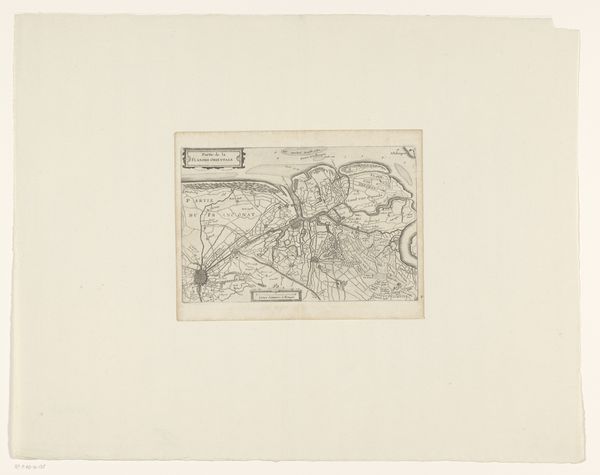
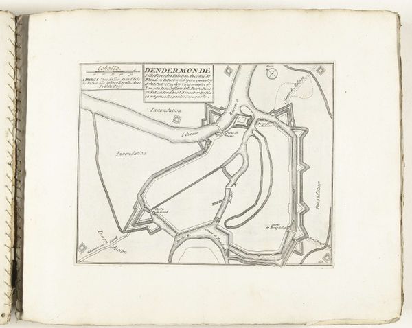
This is an anonymous rendering of the Vestingplattegrond van Dendermonde made with pen and paper. The map offers a stark, linear depiction of Dendermonde, emphasizing its structural layout and fortifications. Lines form a rigid network to represent buildings and waterways, lending a sense of geometric precision. The neutral tone amplifies the diagrammatic nature, inviting us to consider the underlying order and strategic intent behind urban planning. The map is not merely a representation of space; it's an assertion of control. The emphasis on fortifications and strategic waterways speaks to a mindset deeply concerned with power and defense. The absence of color and shading reduces the city to its bare structural elements, highlighting the logic of power embedded in its design. This cartographic rendering of Dendermonde serves not just as a guide but as a statement about the interplay between space, strategy, and social control.
Comments
No comments
Be the first to comment and join the conversation on the ultimate creative platform.
More like this