drawing, paper, ink, pen, engraving
#
drawing
#
dutch-golden-age
#
pen sketch
#
paper
#
ink
#
pen
#
engraving
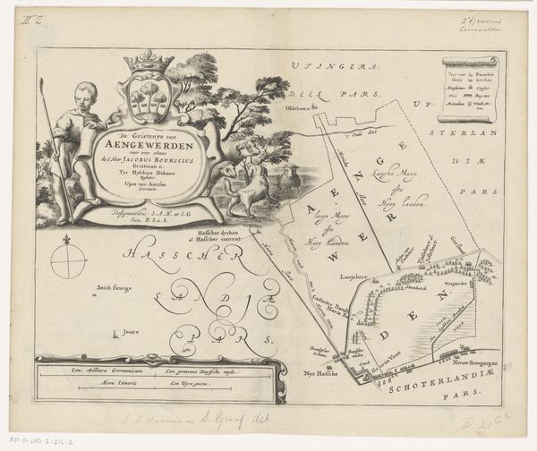
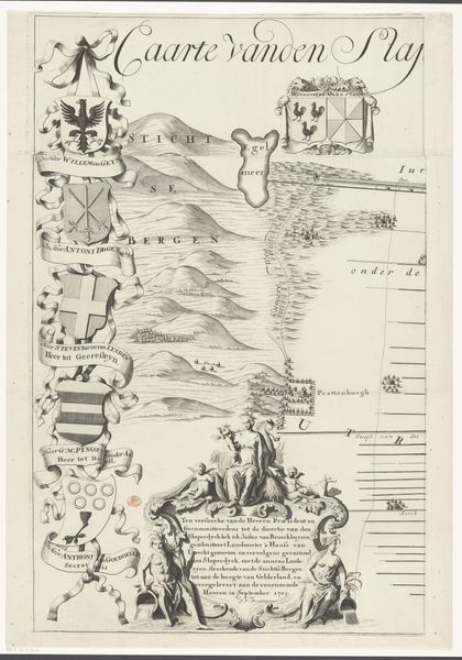
Dimensions: height 259 mm, width 337 mm
Copyright: Rijks Museum: Open Domain
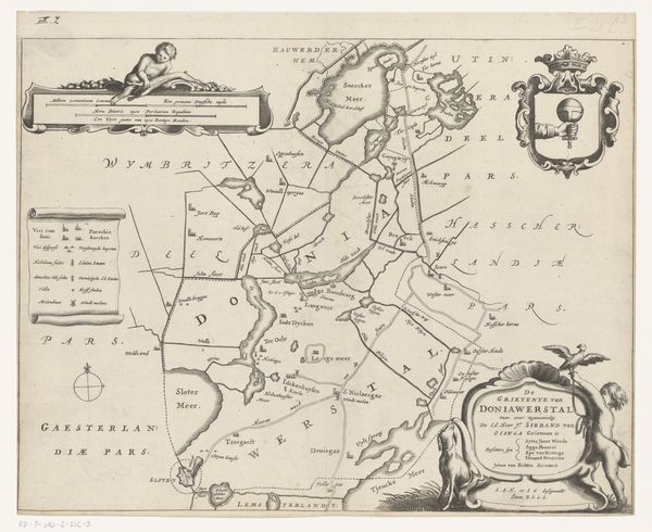
Curator: This is a 1664 map of Haskerland, a region in the province of Friesland. It was created by Jacob van Meurs, rendered in pen, ink, and engraving on paper. Editor: It's quite striking how much narrative is packed into what seems at first glance to be just a simple map. There’s an allegorical scene in the corner and even stylized animals dancing around the lettering. Curator: Indeed! Maps from this era often served multiple purposes. While aiming to accurately depict geographical information, they also reflected the political and social status of the region and its patrons. Editor: Take the imagery on the upper left, for example. We have a hunter and his dog, proudly displaying their prey beneath a heraldic crest featuring a leaping hare. This speaks volumes about the cultural values placed on hunting and land ownership. Curator: Precisely. These details legitimized the ruling powers by connecting them visually with the land and its resources. Maps became powerful tools in constructing identity and solidifying power. Consider also that scale indicator down at the bottom in its elaborate Baroque frame, telling us about measurement, precision, and, in a sense, control. Editor: The cartouche at the upper right, the neatly ordered explanation… They give a sense of authority. But even the map itself is interesting—the carefully rendered fields, the rivers and lakes… were these images as accurate as they aspired to be? Curator: The accuracy would vary. Mapmaking in the 17th century was improving due to advances in surveying, but embellishments and symbolic elements still played a significant role in communicating the map’s message and purpose. It served as much as propaganda than a reliable guide. Editor: It's fascinating how this blend of practical information and symbolic messaging makes it such a rich source for understanding the cultural mindset of the Dutch Golden Age. A frozen moment of societal aspiration. Curator: Absolutely, looking at this map offers insights into not just geography, but into the visual language of power, land, and identity in 17th-century Friesland. Editor: And for me, thinking about it now, that rabbit represents more than a successful hunt—it embodies this whole visual theater about regional authority!
Comments
No comments
Be the first to comment and join the conversation on the ultimate creative platform.
More like this