About this artwork
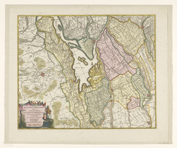
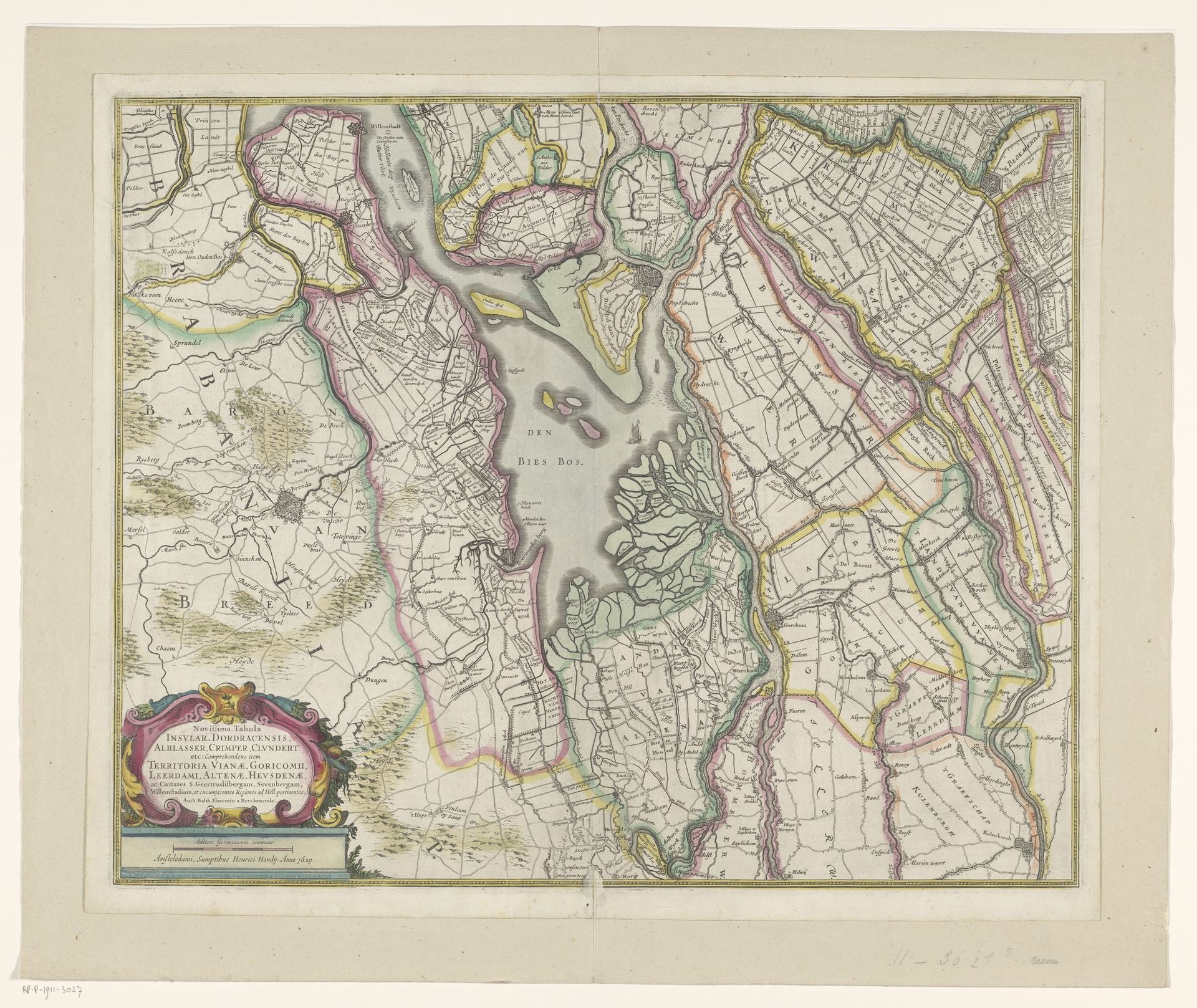
This hand-colored map shows a portion of Zuid-Holland, although its maker remains anonymous. Cartography has always been about more than just geography; it’s an assertion of control over land, a claim to knowledge, and an expression of political power. Made at a time when the Dutch Republic was a major maritime power, this map reflects the economic and strategic importance of the region. Zuid-Holland, with its complex network of waterways, was vital for trade and defense. Note how the map meticulously details not just landmasses but also the intricate systems of polders and dikes. This wasn't just about knowing where places were; it was about understanding how the Dutch reshaped their environment to suit their needs, an engineering feat with profound social and economic consequences. To understand the map fully, we might consult archives of the water boards and town councils from the period, these institutions shaped the landscape but also the lives of those who lived here. Maps are never neutral; they tell stories about power, knowledge, and human intervention.
Artwork details
- Medium
- print, etching, engraving
- Dimensions
- height 455 mm, width 557 mm
- Location
- Rijksmuseum
- Copyright
- Rijks Museum: Open Domain
Tags
aged paper
toned paper
dutch-golden-age
etching
landscape
pattern background
linocut print
engraving
Comments
Be the first to share your thoughts about this work.
About this artwork
This hand-colored map shows a portion of Zuid-Holland, although its maker remains anonymous. Cartography has always been about more than just geography; it’s an assertion of control over land, a claim to knowledge, and an expression of political power. Made at a time when the Dutch Republic was a major maritime power, this map reflects the economic and strategic importance of the region. Zuid-Holland, with its complex network of waterways, was vital for trade and defense. Note how the map meticulously details not just landmasses but also the intricate systems of polders and dikes. This wasn't just about knowing where places were; it was about understanding how the Dutch reshaped their environment to suit their needs, an engineering feat with profound social and economic consequences. To understand the map fully, we might consult archives of the water boards and town councils from the period, these institutions shaped the landscape but also the lives of those who lived here. Maps are never neutral; they tell stories about power, knowledge, and human intervention.
Comments
Be the first to share your thoughts about this work.