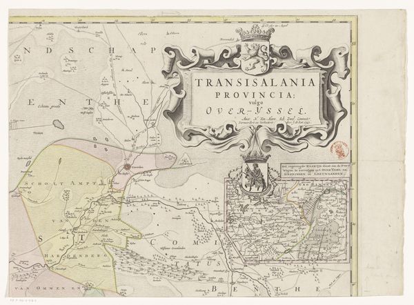
print, engraving
#
baroque
# print
#
pen illustration
#
old engraving style
#
landscape
#
engraving
Dimensions: height 432 mm, width 536 mm
Copyright: Rijks Museum: Open Domain
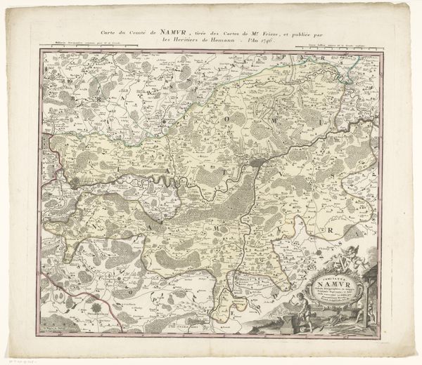
Curator: Let's talk about this intriguing engraving. It's titled "Kaart van Overijssel (deel linksonder)," which translates to "Map of Overijssel (lower left part)," created sometime between 1648 and 1743, by Gerard Coeck. What's your immediate reaction to it? Editor: Mmm, sepia-toned nostalgia with a hint of colonial ambition. There’s something about the precision of these old maps, the imagined bird’s eye view, that always feels bittersweet. It speaks of both control and wonder. Curator: Precisely. Note how the printmaking process allows for a very specific type of visual communication here. Engraving allowed for the mass production and dissemination of knowledge but what also interests me are the choices in cartographic representation during this era and the labour that would go into making all these small and tiny decisions on it, to properly execute this type of design in order to mass produce the artwork, think how impactful the final material ends up being. Editor: Oh, the labor is visible, isn't it? Each tiny tree, each meticulously lettered name. And it’s odd how romantic we make something functional. It makes me think, what narratives and desires were mapped into it, whose stories are prioritized here and forgotten? Curator: A fair point. Maps are, in their very nature, biased representations. They were powerful instruments for exerting territorial claims but you do wonder if maybe there´s not only material interests at stake but personal intentions as well from the cartographers who decide which place receives what relevance according to the artist criteria. The choice of pen strokes, type of letters, materials; everything works together in creating the final landscape feeling the artwork has to offer. Editor: Absolutely. All those meticulously etched lines… I keep wondering about the cartographer dreaming about these places in this time period. About him trying to compress space and scale into a manageable frame. What he choose to include and discard. And isn´t the fact it is fragmented fascinating? Maybe these lower halves and little portions show that this man just wanted to be part of something bigger himself. Curator: Food for thought! This dissection shows a tiny picture but also gives birth to bigger questions when confronted as its own independent entity of its full representation, as one to appreciate and keep looking forward. Editor: Yes. And perhaps that’s the allure of these historical artifacts. Not just where they show us, but the imaginative journeys they set in motion.
Comments
No comments
Be the first to comment and join the conversation on the ultimate creative platform.
More like this