drawing, print, architecture
#
architectural sketch
#
drawing
#
neoclacissism
# print
#
landscape
#
geometric
#
architectural section drawing
#
architectural drawing
#
architecture drawing
#
cityscape
#
architecture
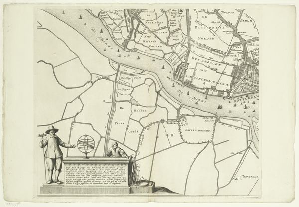
Dimensions: height 652 mm, width 885 mm
Copyright: Rijks Museum: Open Domain
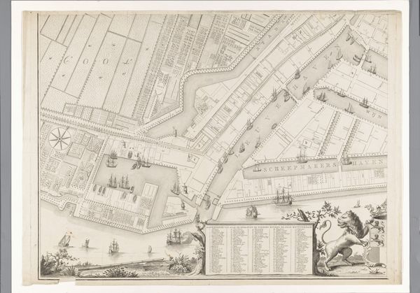
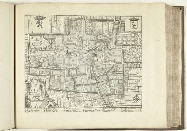
Curator: Here we have a detailed section of the “Plattegrond van Rotterdam”, or Plan of Rotterdam, created around 1800 by Cornelis van Baarsel. It’s a print showcasing the city's layout, a fascinating intersection of art and cartography. Editor: Wow, it's incredibly intricate! My first thought is of an old-fashioned board game, a strategy game with waterways and wharves as the playing field. Curator: Indeed, its precision reveals more than just geography. It's a window into the cultural and economic priorities of Rotterdam at the turn of the 19th century. Notice the emphasis on the waterways—they are clearly central to the city's identity. Editor: Absolutely! The rivers almost seem like veins, arteries pumping life into the city. And there's a fascinating list, almost like an index, framed like a classical monument, down at the bottom there. It's lovely, though a bit sterile, don't you think? All that rational planning! Where's the romance? Curator: Neoclassicism, as a movement, valued order and rationality. Look at how Van Baarsel employed meticulous lines and geometric forms. Even the inclusion of the Dutch Lion adds a symbolic layer; it's a declaration of civic pride and a nod to the city's strength in trade and navigation. The lion embodies those values that tie that city's cultural memory. Editor: True. That lion seems almost like a grumpy gatekeeper of all that efficiency! Yet, thinking about it, maps are romantic in their own way, aren't they? Each street a potential story, every building a secret life. The chart, as a symbolic gesture. It offers up this tantalizing sense of possibilities. Curator: I agree. And Baarsel’s artistic rendering, more than a dry technical document, makes us consider Rotterdam as more than just buildings and waterways; it is a cultural organism, a vessel of historical aspirations, and future dreams. Editor: Looking at it this way I almost want to pull out my suitcase and start exploring the living city, seeing what echoes of this version of Rotterdam persist in the streets today. Curator: That’s the charm of an icon. Thank you for seeing it through an artist's eyes! It has enriched my understanding of its layers of cultural meaning as well.
Comments
No comments
Be the first to comment and join the conversation on the ultimate creative platform.
More like this