print, etching, engraving
#
dutch-golden-age
# print
#
etching
#
landscape
#
engraving
#
realism
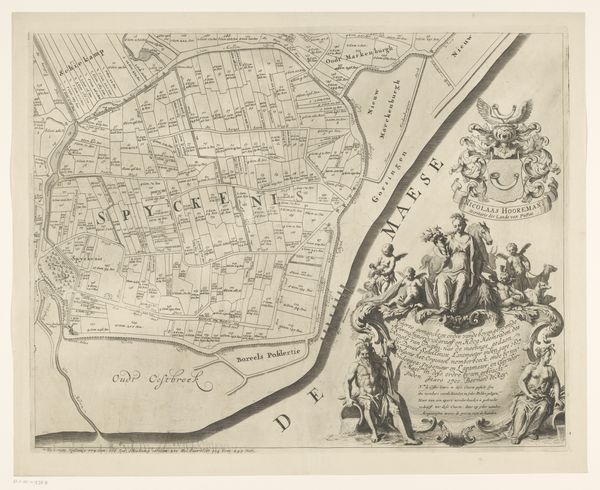
Dimensions: height 478 mm, width 544 mm
Copyright: Rijks Museum: Open Domain
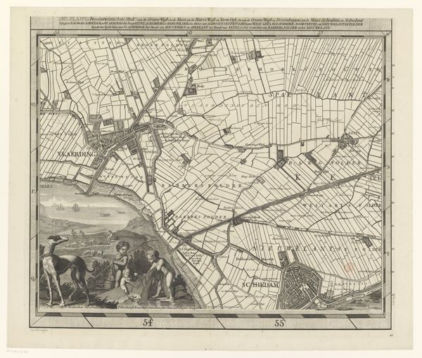
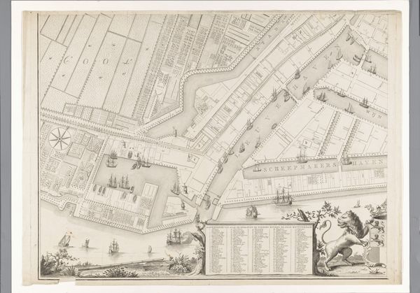
Curator: Ah, yes, this print, "Kaart van de Zijpe- en Hazepolder," a detailed map of the Zijpe- and Hazepolder region dating between 1665 and 1760, attributed to Reinier van Persijn. What's your take on it? Editor: My first thought? It feels so incredibly organized, doesn't it? All those carefully delineated rectangles and lines…it's almost soothing, but there's a real detachment too, seeing land reduced to shapes and measurements. Curator: Exactly! The genius of this etching and engraving lies in its abstraction. Look at how the rigid grid system reflects a deep intervention into the natural world. The lines demarcate fields and waterways with an almost clinical precision. Editor: It's beautiful, yes, in its own ordered way, but I am immediately drawn to that cluster of people and animals at the bottom right of the composition—a touch of the everyday. A stark contrast to all the geometry, if you ask me. Curator: The pastoral scene is indeed a clever move, reminding us of the human element—of labor, and also of dominion. The animals look weary, perhaps, adding a poignant counterpoint. This cartographic print also incorporates a compass rose for navigation and that beautifully flourished title cartouche! Editor: Those details add a layer of, dare I say, richness. Knowing this would have been used practically... it also feels like it speaks to humankind’s relationship to place. It reminds me of trying to capture memory, where a certain rigidity can also carry something incredibly evocative, too. Curator: A perfect parallel, I think. By emphasizing clarity and structure, Van Persijn isn’t simply documenting the land; he is illustrating control, ambition and also the very human desire to catalogue our world. It's about space but also about the time and work that shapes the land itself. Editor: True, in the map's careful lines and detailed symbolism we glimpse something much deeper – our attempts to chart not only the physical, but the intangible aspects of how we engage with a space and, I suppose, claim ownership of it too. What starts as measurement turns into something else entirely. Curator: A convergence of art, science, and the quiet poetics of place... indeed. Editor: It’s something I think I'll consider every time I see a map. Thanks.
Comments
No comments
Be the first to comment and join the conversation on the ultimate creative platform.
More like this