print, engraving
#
dutch-golden-age
# print
#
geometric
#
genre-painting
#
engraving
Dimensions: height 484 mm, width 578 mm
Copyright: Rijks Museum: Open Domain
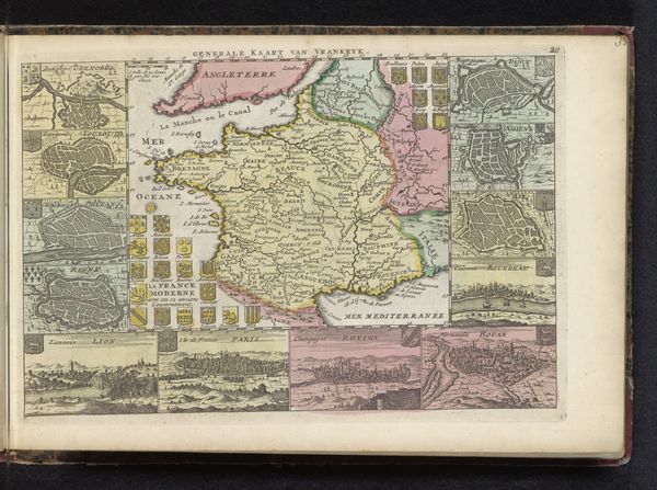
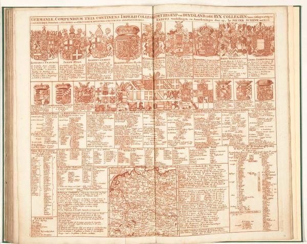
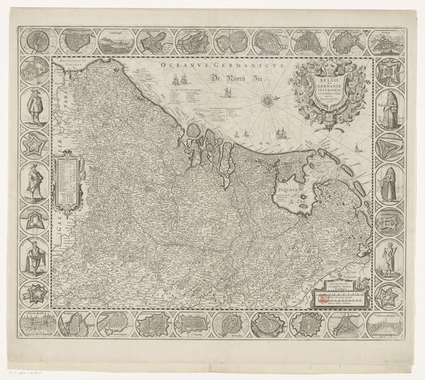
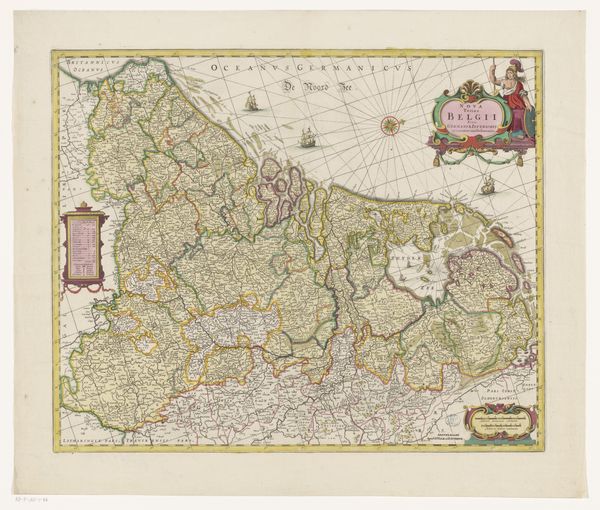
Editor: This is “Kaart van de Zeventien Provinciën met uitleg,” a print, specifically an engraving, from after 1706. It’s currently held at the Rijksmuseum. The artist is Caspar Specht. I’m struck by how this map isn’t just a geographic representation, it seems almost like an infographic with all the text and crests. How do you interpret all these symbolic elements? Curator: This "map" goes far beyond geographical accuracy, it presents a cultural memory. It uses a specific visual language to convey layers of information beyond just place. Notice the prominence given to the heraldic symbols alongside each province; these weren’t merely decorative, but claims of power, lineage and authority deeply ingrained in the visual culture of the time. How do these symbols inform our understanding of Dutch identity then? Editor: It’s like each province had its own visual brand! So the map becomes less about navigation and more about asserting these regional identities. Does that also reflect the complex political landscape of the Dutch Republic at the time? Curator: Precisely! This complex visual language creates and reinforces specific cultural narratives that impact identity and potentially legitimize dominion. Can you see the impact these kind of visual choices have in defining social and cultural perceptions? Editor: It's fascinating to consider how seemingly simple choices – what to include, what to emphasize – can shape cultural memory for generations. I had seen these heraldic crests only as regional insignia and didn't read them as markers of cultural legacy and claims. Thank you! Curator: Likewise, each time we explore symbols we bring these inherited narratives closer to a clearer, modern, perspective.
Comments
No comments
Be the first to comment and join the conversation on the ultimate creative platform.
More like this