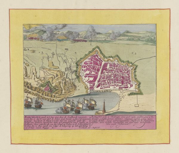
print, watercolor
#
baroque
# print
#
watercolor
#
cityscape
#
history-painting
#
watercolor
Dimensions: height 454 mm, width 592 mm
Copyright: Rijks Museum: Open Domain
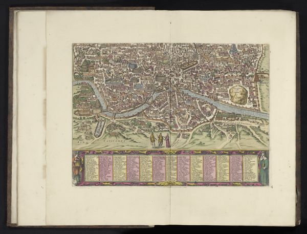
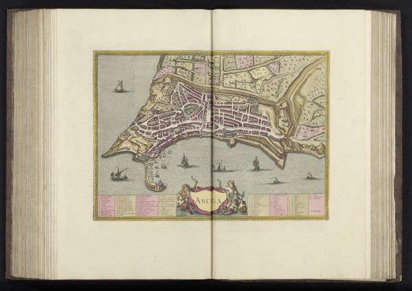
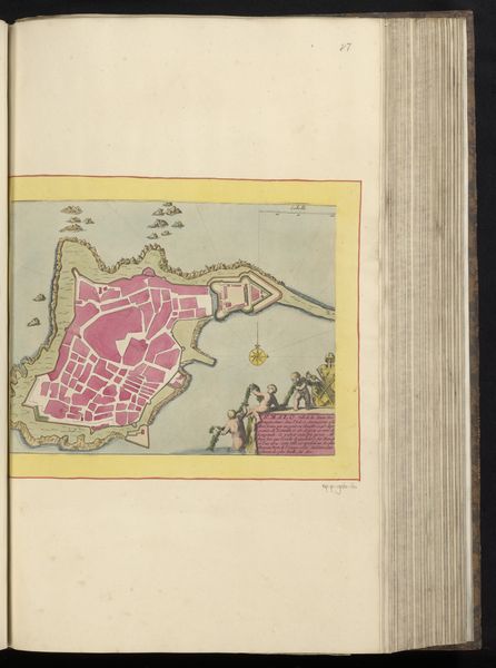
Editor: This watercolor print, "Kaart van het beleg van Barcelona, 1706" by Pieter van (II) Call from 1706 shows a fascinating depiction of the city under siege. It’s striking how the details of the city are presented. What draws your attention when you look at this map? Curator: I am drawn to the intersection of artistry, labor, and historical record. The "Kaart van het beleg van Barcelona" functions not merely as a representation, but as a commodity. Consider the physical effort: the preparation of pigments, the engraving of the plate, the printing process itself. Editor: So, you are focused on the labor? Curator: Exactly. The act of mapping transforms the raw materials – paper, ink, watercolor – into a saleable object, embedded with geopolitical implications. This detailed visualization aided military planning, of course. How does this influence its status as "art" for you? Editor: That’s an interesting angle; it makes you think about the print’s original functionality versus how we consider it now, displayed in a museum. Curator: Yes, and beyond functionality. Consider how the materials and their transformation serve power. A map defines territory; controlling its creation and distribution wields significant influence. It underscores how artistic production is entwined with labor and societal hierarchies. Editor: I never thought of it that way before. I'm starting to consider the paper, the ink, and how these were acquired and used to produce something that served military objectives. It's not just an image. Curator: Precisely. It is a confluence of material processes and socio-political forces shaping perception. Editor: Thanks! That gives me a lot to consider.
Comments
No comments
Be the first to comment and join the conversation on the ultimate creative platform.
More like this