drawing, print, etching, engraving
#
drawing
# print
#
etching
#
landscape
#
cityscape
#
engraving
Dimensions: height 325 mm, width 428 mm
Copyright: Rijks Museum: Open Domain
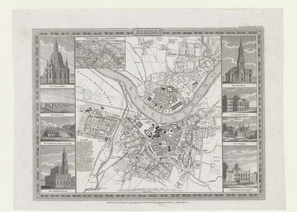
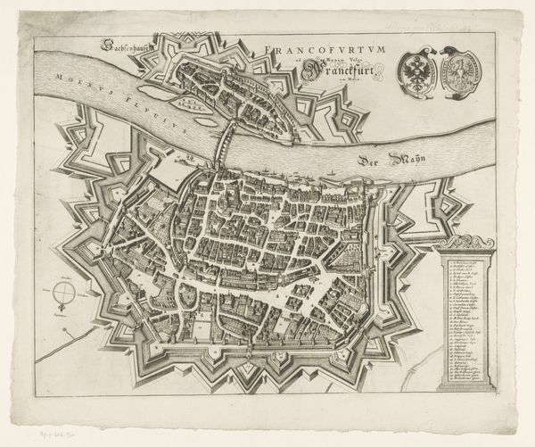
This detailed map of Magdeburg with eleven city views was made by Johann Georg Serz. Its fine lines and intricate detail were achieved through the process of engraving. Serz would have used a tool called a burin to cut lines directly into a metal plate, likely copper. Ink is then forced into these lines, and the plate is pressed onto paper, transferring the image. Look closely, and you can see how the density of these engraved lines creates the tones and textures of the map and the surrounding vignettes. Engraving has a long history, traditionally associated with printmaking and illustration. Serz’s skill transformed a practical tool for urban navigation into an aesthetic object. The labor-intensive process and the precision required also speak to a wider social context of craftsmanship and industry in the 19th century. Understanding the materials and processes used in this map allows us to appreciate not only its functional value but also its artistic merit, blurring the lines between craft and fine art.
Comments
No comments
Be the first to comment and join the conversation on the ultimate creative platform.
More like this