drawing, print, etching, paper
#
drawing
# print
#
etching
#
landscape
#
etching
#
paper
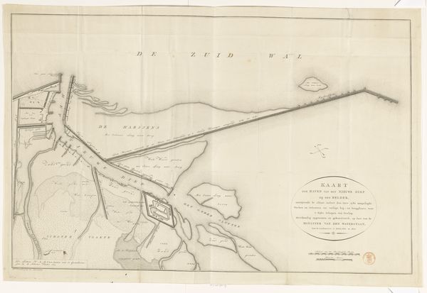
Dimensions: height 606 mm, width 875 mm
Copyright: Rijks Museum: Open Domain
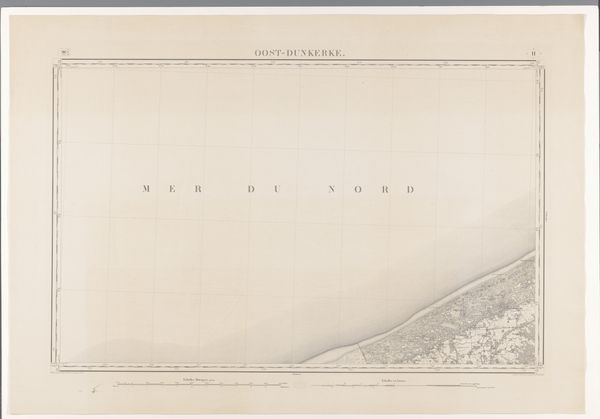
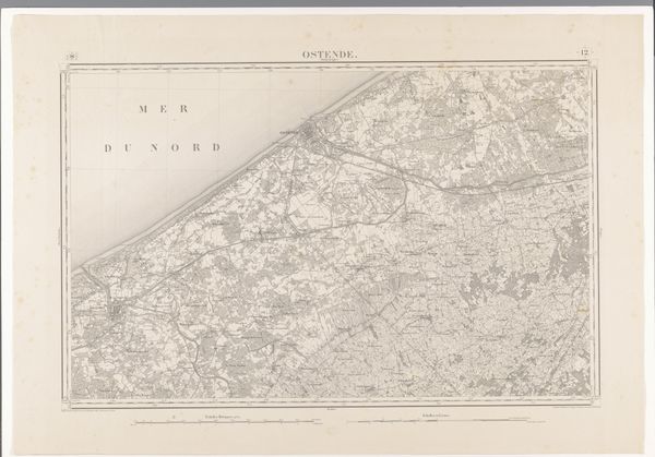
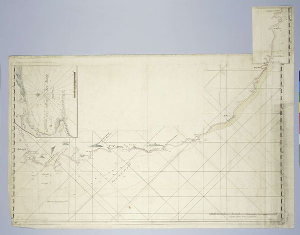
Curator: Here, we have a remarkable cartographic etching titled "Kaart van de Noordzee voor de kust van Blankenberge," a map of the North Sea off the coast of Blankenberge, created in 1862. Editor: It feels remarkably…sterile. An almost ghostly image; all pale tones with that exacting grid overlaid. There’s something unsettling about seeing the sea reduced to this ordered space. Curator: Maps are often about control, about asserting a human perspective over nature. The starkness could be reflective of a specific societal drive to understand and, thus, to manage the seascape. You’ll see the subtle shifts in tone indicating depth, representing hidden dangers but also resources. Editor: That attempt to render a flat space also as depth…it fails, interestingly, and becomes symbolic. It’s almost a record of colonial aspirations— to claim both physical and intellectual mastery over these spaces, defining and thus limiting, them. The choice of paper for this medium…the lack of depth it offers, speaks loudly. Curator: Absolutely. Consider how coastlines themselves act as interfaces, constantly being eroded and reshaped by tidal forces. Mapping it freezes that fluidity, establishing it in a specific historical moment—it’s documentation of place. And of intention. Even the North Sea, as turbulent as it can be, is tamed into neat sections and lines, allowing navigation, commerce. Editor: Yet there's still beauty here, in the dedication to this kind of obsessive capture, it reflects how humanity looks to nature. But the "human element" so to speak can lead to disastrous effects; one could ponder how such visual representations of a natural resource can inform decision making. And in this map it already points to that exploitation; something rendered ‘measurable’ is ready to be conquered and divided. Curator: Maps not just show space, but how a certain culture conceives of space, reflects that specific value system back. So what might appear as a technical document opens up broader, societal issues to reflect upon. Editor: It is not a clear representation; but a very good display on the complexities of natural space and culture at play.
Comments
No comments
Be the first to comment and join the conversation on the ultimate creative platform.
More like this