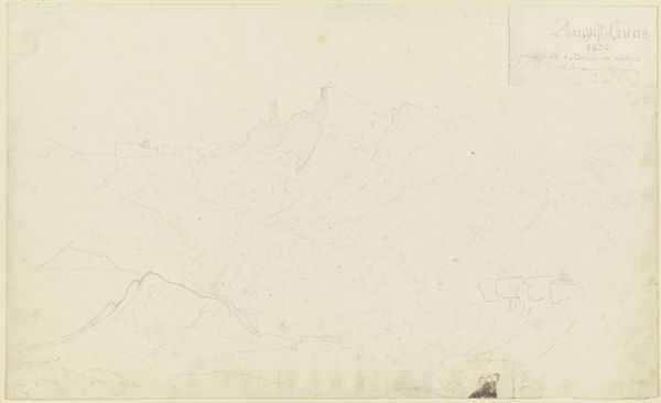
drawing, paper, ink
#
drawing
#
neoclacissism
#
landscape
#
paper
#
ink
#
realism
Dimensions: height 284 mm, width 482 mm
Copyright: Rijks Museum: Open Domain
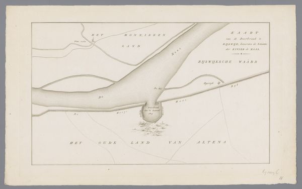
Editor: This is "Kaart van dijkdoorbraak te Loo, 1809", an ink drawing on paper by an anonymous artist. It’s fascinating – almost like a ghostly, pale landscape. What strikes me is how functional it appears; more a technical diagram than a purely aesthetic piece. How should we approach reading this? Curator: Precisely! Consider the materials: ink and paper, readily available and relatively inexpensive at the time. This suggests a function beyond ‘high art’. This map, detailing a dike breach, directly relates to labor, land management, and control of resources. Note how the topographical rendering becomes a form of inscription, dictating land ownership and potential economic exploitation. The map itself is an instrument of power. Editor: So, the material context illuminates the function... how the map literally reshapes the landscape, and access to resources, even on paper. Is it challenging the boundary between fine art and functional document? Curator: Exactly! Think about the labour involved in its production, too. Surveying the land, producing the ink, drawing each line... it represents invested time and expertise in the manipulation and visualization of resources and how it influenced both the natural and social context. Who commissioned this map? What would they use it for? These questions ground the work within specific socio-economic realities. Editor: I hadn't thought about the labor involved so much. The seemingly delicate lines belie a huge effort of surveying, representing damage but also envisioning repair, recovery, and the reconstruction of property after devastation. Curator: Yes, it exposes the underlying framework. And by focusing on the material process, we see the human hand – and its social and political context – at work, shaping the landscape on multiple levels. Editor: That makes so much sense. By looking at the materials and how the map would have been used, we gain a far richer appreciation for it, and appreciate the social contexts. Thank you! Curator: Absolutely. It’s about seeing the material reality *behind* the image and what it exposes about land, ownership, and the processes of power at play.
Comments
No comments
Be the first to comment and join the conversation on the ultimate creative platform.
More like this