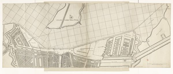
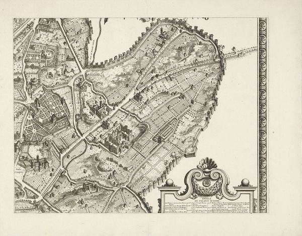
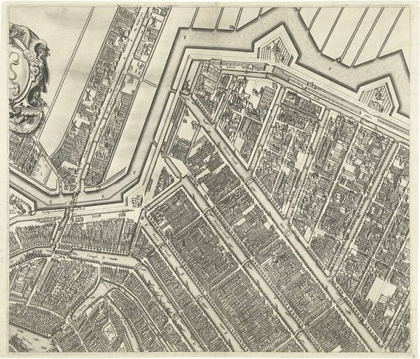
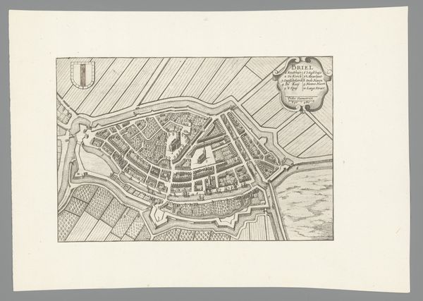
Plattegrond van de Kaart Figuratief van Delft (deel rechtsboven) 1678 - 1752
0:00
0:00
johannesderam
Rijksmuseum
drawing, print, ink
#
drawing
#
dutch-golden-age
# print
#
ink
#
geometric
#
cityscape
Dimensions: height 372 mm, width 620 mm
Copyright: Rijks Museum: Open Domain
Curator: Here we have "Plattegrond van de Kaart Figuratief van Delft (deel rechtsboven)", a segment from a larger map of Delft, likely dating between 1678 and 1752, attributed to Johannes de Ram. The rendering utilizes ink on drawing and print mediums. Editor: At first glance, this feels less like a map and more like an intricate puzzle. All those tiny, neatly organized rectangles! It's beautiful, but also slightly overwhelming. I’m curious, how did someone even begin to draft something like this? Curator: Indeed, these cityscapes were highly prized, both for their practical use in navigation and civic planning, and for their symbolic representation of urban power and sophistication in the Dutch Golden Age. Mapmakers played a crucial role in shaping the image of a city and conveying its significance on a broader stage. The details you observed reflect meticulous survey and documentation practices that served as emblems of civic pride. Editor: That makes sense. There’s such pride evident in the obsessive detail. Those symmetrical fields especially appeal. So it isn't just about accurate mapping, there's a deliberate element of showing off what the city values most. It feels like propaganda—in a nice, cartographically stunning way. Curator: Precisely! Look at the coats of arms and decorative elements worked into the borders. These embellishments served not just an aesthetic purpose but underscored the power and legitimacy of Delft, strategically placing it within a hierarchy of cities and states. The placement within important collections was used as visual promotion of that city's brand. Editor: Seeing those symbols, those visual cues gives the whole piece so much more character. It hints at a human story—political maneuverings, civic ambition—that would be easy to miss focusing purely on the grid of the city. I am also intrigued by what’s cropped out from other map parts, maybe in another visit… Curator: Agreed, framing influences reception, sometimes revealing and concealing different intentions in similar strokes. I hope this glimpse into Delft from centuries ago leaves us reflecting on not just geography, but also what shapes the narratives we find within seemingly objective representations. Editor: Well said, it's like each line tells not only where the roads go, but who decided where they would go, and why... I can feel echoes of all the deliberations baked into it, somehow. Fascinating.
Comments
No comments
Be the first to comment and join the conversation on the ultimate creative platform.
More like this