print, engraving
baroque
perspective
cityscape
engraving
Dimensions: height 529 mm, width 423 mm
Copyright: Rijks Museum: Open Domain
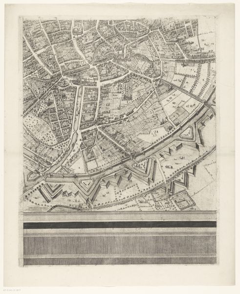
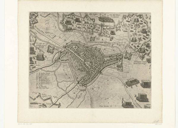
This is an anonymous map of Brussels, made using etching, and part of a larger whole. Maps are never neutral; they reflect the priorities and power structures of those who commission and create them. Consider what this map includes, and what it leaves out. Fortifications dominate the landscape, underscoring military might, with a focus on strategic advantage. In cartography of this era, the inclusion of religious symbols or buildings often served to reinforce cultural identity and solidify social cohesion. The lower left detail depicts what I believe to be the Cathedral of St. Michael and St. Gudula, framed reverently by a parade of people, this section suggests the deep intertwining of religious, civic, and military life, highlighting their roles in shaping collective identity and asserting dominance. Look closely, and ask yourself: whose stories are being told here, and whose are being erased? Consider that such a document also served to reinforce social hierarchies, dictating who belonged and who was considered an outsider in this landscape.
Comments
No comments
Be the first to comment and join the conversation on the ultimate creative platform.